Multipitch Atlas

Voie Jaune

Les Chéserys (Aiguilles Rouges) · Chamonix valley · France

Easy to bailBolting confidence: high

A short, friendly slab route on the sunny gneiss of the Chéserys, facing the Mont Blanc range. Five pitches with one vertical step of 4c, chain belays and an abseil descent make it a standard introduction to multipitch climbing.

The Chéserys slabs above the forest, below the Aiguilles RougesPhoto: Christian · CC BY-SA 3.0

Photo

The Chéserys slabs above the forest, below the Aiguilles RougesPhoto: Christian · CC BY-SA 3.0
Hardest pitch
4c
Pitches
5
Length
150 m
Approach
60 min
Aspect
S
South-facing
Rope
2×50 m

The route

Overview

The Voie Jaune is one of the easiest of the colour-named routes on the Chéserys slabs, below the Aiguillette d'Argentière in the Aiguilles Rouges. It gives five short pitches of adherent slab with a leaning corner on pitch 3 and a short vertical step at the start of pitch 5. The rock is very good for the grade and the views across to the Aiguille Verte and Mont Blanc are the main attraction. Most parties abseil the route.

The climbing

Pitch by pitch

Pitches of Voie Jaune
PitchGradeLengthNotes
P14b35 mSlab on adherent rock, with slightly thinner moves between the second and fourth bolts. A 2026 Basque party gave it 4c and a 2024 party thought it nearer 5a.
P24b30 mMore slab; the 2026 description has you leave towards a corner and then trend left over easy-angled slabs to the belay.
P34a30 mA pleasant leaning corner, given 3c/4a on camptocamp.
P43c20 mA short pitch on easy-angled slabs to a small ledge below a steepening. It can be linked with pitch 5 (about 45 m).
P54c35 mA short vertical step off the belay with one move of 4c, easiest on the left on good holds, then slabs to the top belay. A 2024 party thought it nearer 5b.

Getting there

Approach

To the parking

Drive or take the bus from Chamonix through Argentière towards the Col des Montets and park at Tré-le-Champ (about 1420 m), 500 m before the col. By train, get off at Montroc-Le Planet, about 20 min on foot from Tré-le-Champ. The Col des Montets road can close in winter.

On foot · about 60 min

From Tré-le-Champ take the Chéserys path that climbs towards Lac Blanc past the Aiguillette d'Argentière. After about an hour (one 2026 party took 40 min), where the path climbs a flight of log steps, take a faint path along the foot of the cliff. The start is about 150 m right of the Voie Bleue, at a stepped slab; the name is written small on the rock to the left of the first bolt and is fading. Several parties took a while to find it.

Finding the route · 3 photos

Approach photo

Map of the walk-in

  • Crag
  • Parking
  • GPS line

Loading map

The point marks the crag, not the exact start of the route.

GPS line: a line of the whole day, including the climb and the descent drawn by its source, not a recorded track. Line attached to the camptocamp route page (identical to the GPS track of oskarmorales's outing of 25 July 2026): a loop from Tré-le-Champ up to the Chéserys slabs and back. Do not follow it blindly.

GPS line: camptocamp.org contributors · CC BY-SA 3.0

Coordinates · crag

45.98724, 6.91410

Parking

46.00361, 6.92333

Col des Montets (camptocamp waypoint 104280); the Tré-le-Champ car park is 500 m before the col

Point from camptocamp waypoint 41533

For your phone or watch

Download GPX

Contains the route point, parking and a GPS line. Opens in most mapping apps and GPS watches.

Points are compiled from published sources, with the precision stated above. They were not surveyed on the ground: check them against a current topo.

Getting down

Descent

Abseil the route in three abseils from belays 5, 3 and 2, the longest about 50 m. Parties take 1 h to 1 h 30 min. Alternatively, top out over easy rock steps that cannot be protected, then grass with a faint path, to join the Lac Blanc path.

Retreat

Bailing off the route

Easy to bail

Abseiling the route is the normal descent and the belays are chained with a maillon. The standard abseils leave from belays 5, 3 and 2; from belays 1 and 4 you would abseil to the next station down. With two 50 m ropes retreat is simple from anywhere.

Retreat from
Any belay; the documented abseil stations are belays 5, 3 and 2.
Point of no return
None.
Carry
2×50 m ropes. With a single rope you would need to check that each pitch (up to about 35 m) can be abseiled, which a single 50 or 60 m rope does not allow.
Basis
Stated in the sourcesCamptocamp and a 2026 report both describe the abseil descent and chained belays; the single-rope remark is inferred from the pitch lengths.

Safety

Hazards

  • Ibex walk above the cliff and knock stones down; wear a helmet. In July 2025 the top belay was reported damaged by rockfall.
  • Several parties find the bolts a little spaced for complete beginners, though the climbing there is easy.
  • The exit over the top is on unprotectable rock steps.
  • The crag is in the Aiguilles Rouges nature reserve; follow the reserve rules.

Sun and weather

Conditions

South-facing slabs at about 1800 to 1900 m. Reports run from late May to October; in May snow patches can still lie at the foot of neighbouring routes. October is recommended for fewer people.

Usual season · Jun to Oct

Sun on the wall · S-facing

Working out the sunlit hours for this month.

  • January: not yet worked out
  • February: not yet worked out
  • March: not yet worked out
  • April: not yet worked out
  • May: not yet worked out
  • June (usual season): not yet worked out
  • July (usual season): not yet worked out
  • August (usual season): not yet worked out
  • September (usual season): not yet worked out
  • October (usual season): not yet worked out
  • November: not yet worked out
  • December: not yet worked out

Sun on the wallDaylight, wall in shade● Usual season

Estimated from the wall's aspect only. Ignores surrounding terrain, gullies and the wall's exact shape. Clock times are local to the wall (Central European time), for the 15th of each month.

Climate figures for Chamonix valley are not available yet

What to carry

Gear

Ten quickdraws, 2×50 m ropes for the abseils, helmet. Pitch lengths in the list are from a 2026 trip report; camptocamp says only that pitches are 20 to 30 m.

Checklist

Quickdraws
10
Rope
2×50 m
Helmet
One each
Abseil device and prusik
The descent or the retreat involves abseiling

Derived from the route data; check it against a current topo

From climbers

Reader reports

Reader reports are not being collected yet. Until they are, check a current topo and the local club or guidebook publisher for recent changes to Voie Jaune.

Worth knowing

Tips

  • The name at the base is small and fading. Look for a very low first bolt on the stepped slab well right of the Voie Bleue.
  • The route takes about 1 h 30 min to 2 h, so it combines well with a second route on the same slabs.
  • Check the state of the top belay before committing to the abseil.

Open questions

Where sources disagree

  • Length: camptocamp gives 100 m of height; a 2026 report gives 150 m of climbing in pitches of 35, 30, 30, 20 and 35 m. The report's lengths are used.
  • Pitch grades: camptocamp gives 4b, 4b, 3c/4a, 3c, 4c; the 2026 report gives 4c, 4b, 4b, 4a, 4c; a 2024 party felt pitch 1 was 5a and pitch 5 was 5b.
  • Start: the French text puts the start 150 m right of the Voie Bleue, the English camptocamp text says left. Trip reports confirm right.
  • Approach time: one hour on camptocamp, 40 min in the 2026 report.

Provenance

Sources

Same area

More in Chamonix valley

All routes in Chamonix valley
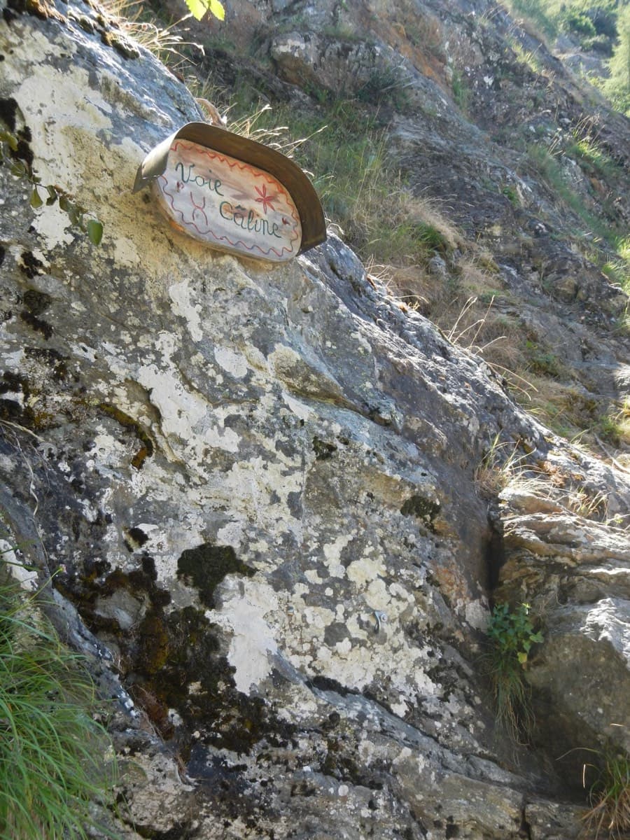
The painted sign marking the start of the Voie Câline on the Rocher des Mottets

France · Chamonix valley

Voie Câline

Nineteen very short pitches of easy slab above Les Bois, never harder than 4b and bolted like a climbing school. It is the standard first multipitch of the Chamonix valley, long enough to feel like a real outing and finishing at a mountain café with a view of the Mer de Glace.

4b19 pitches260 m
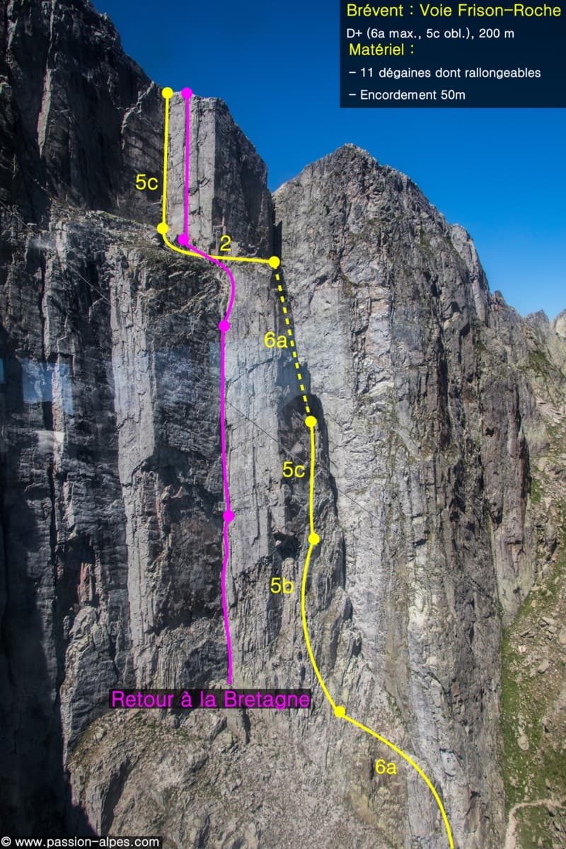
Photo-topo of the Voie Frison-Roche on the Brévent (yellow line), with the neighbouring Retour à la Bretagne

France · Chamonix valley

Voie Frison-Roche

The great classic of the Aiguilles Rouges: six varied pitches of gneiss, ten minutes downhill from the Brévent cable car and finishing at its top station, with Mont Blanc opposite. The crux is a short, physical corner crack and the last pitch is a long, clean corner. It is extremely popular.

6a+6 pitches200 m

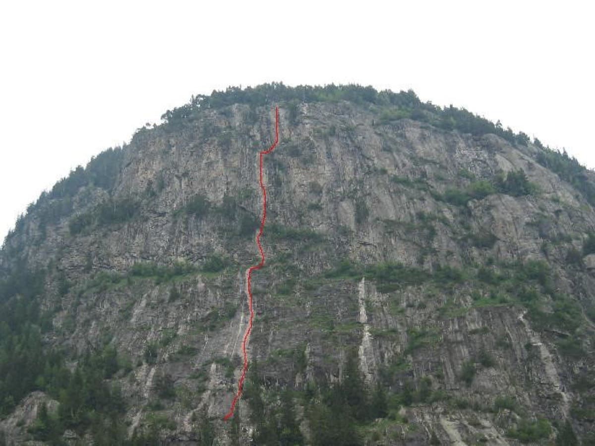
The Barberine wall with the line of Méduse drawn in red

France · Chamonix valley

Méduse

A direct line up the big south-facing slabs of Barberine: three pitches of friction slab to warm up, then steeper, technical walls on small holds. The two top pitches are graded 6b+ and 6c+ if you step round the bolts and 7a if you climb straight up them; 6c is obligatory.

7a7 pitches230 m

Around 4c · about 5 pitches

Similar elsewhere

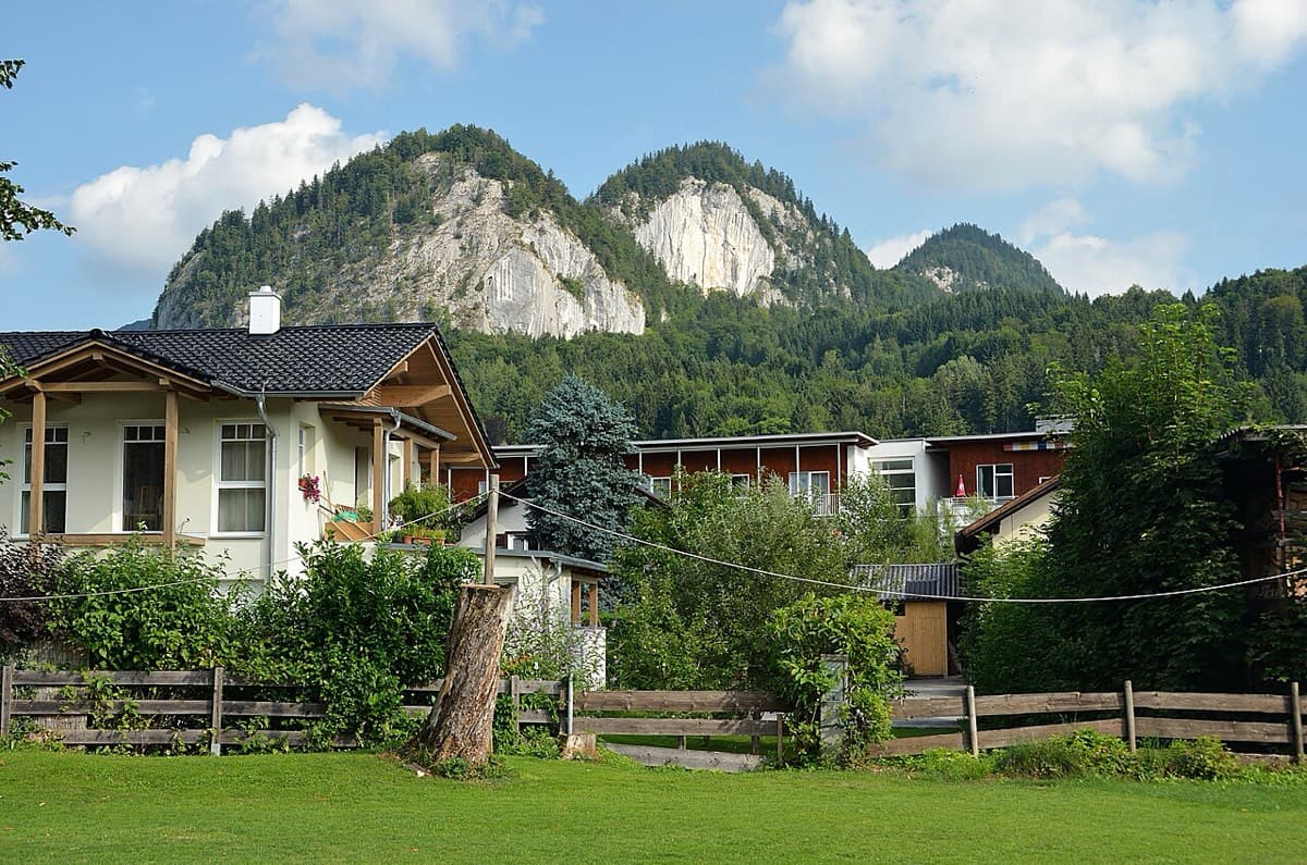
The Plombergstein and Steinklüfte cliffs above St. Gilgen, seen from the village

Austria · Salzkammergut

Juniperus

Five easy pitches up an edge above the Wolfgangsee, mostly UIAA 4 with a few moves of 5-. A slab low down and an exposed step across a cleft on pitch 4 are the memorable bits. A popular first multipitch.

4c5 pitches150 m

No photo yet

Spain · Riglos & Agüero (Mallos)

Normal a la Aguja Roja

The easiest way up a real Riglos summit: five short pitches of 4c on a ramp, a crack and a chimney, steep enough to feel like proper climbing. It is the standard beginners' route and the descent for the whole needle, so expect queues and people abseiling past you. In shade most of the day.

4c5 pitches100 m

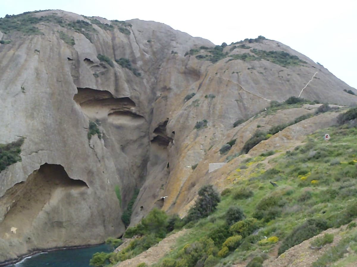
The Bec de l'Aigle above the Anse du Sec, La Ciotat; L'Atelier Bleu follows the runnel in the centre

France · Calanques

L'Atelier Bleu

An oddity: easy slabs and a long water-worn runnel up a dome of puddingstone above the sea, reached by abseiling into a cove from the Mugel park. The climbing is grade 3 and 4 on surprisingly solid pebbles. It was fully rebolted in 2024 and is a popular first multipitch.

4c6 pitches220 m

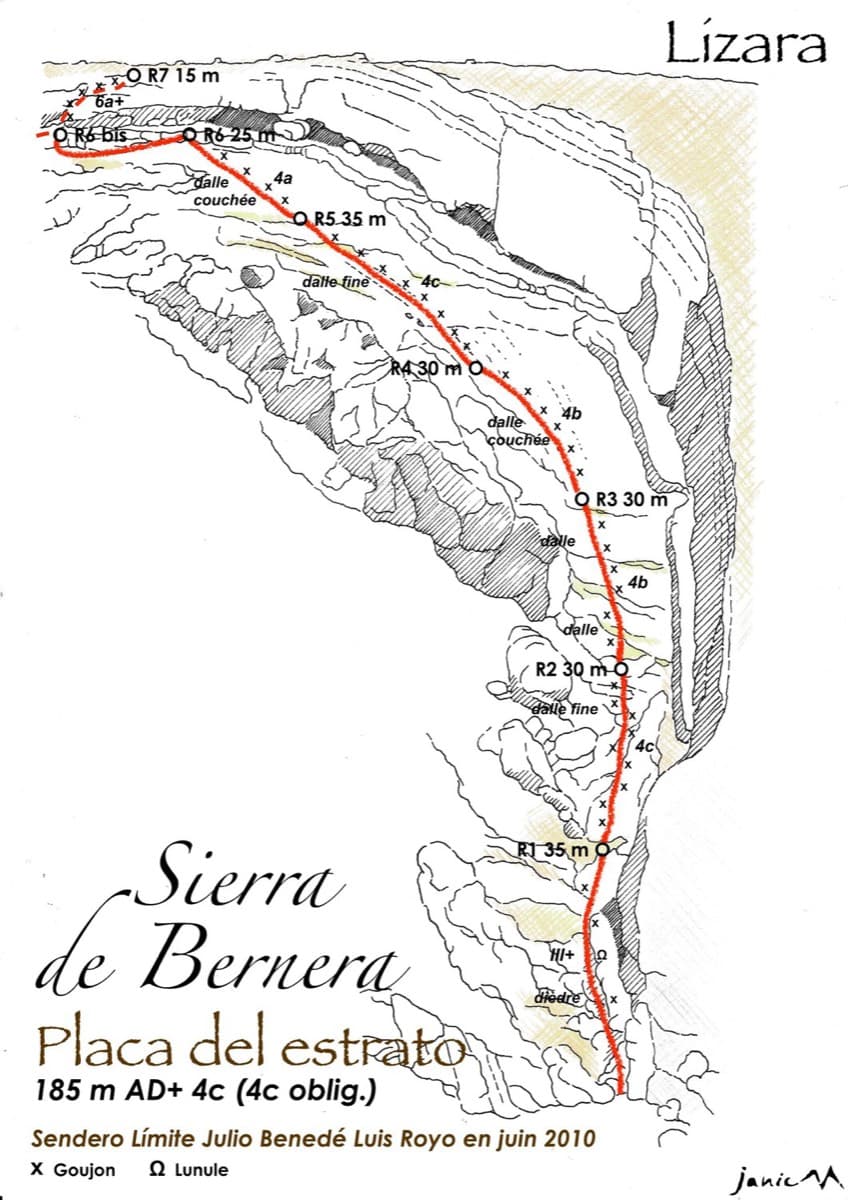
Drawn topo of the Placa del Estrato on the Sierra de Bernera above Lizara, with bolts and belays marked

Spain · Western Aragonese Pyrenees (Lizara)

Placa del Estrato

Six pitches of easy limestone slab up the great folded stratum above the Lizara refuge, parallel to the unbolted Chimenea del Estrato. Friction and small edges at 4b to 4c, with runnels on the upper pitches, in a high pasture setting. A mountain day at a beginner's grade, with an hour's walk in.

4c6 pitches185 m

Compiled from published sources and last verified October 2026. Bolts, anchors and access change. Climbing is dangerous and you are responsible for your own decisions: check a current topo and read the disclaimer.