Multipitch Atlas

Cerces

France

The Cerces are the limestone peaks north of the Col du Lautaret, between the Guisane and Clarée valleys. Their compact, sharp, high-altitude limestone, on walls such as the Tour Termier, the Tête Colombe and the towers of the Queyrellin, carries many long bolted routes opened by Jean-Michel Cambon. The Tour Termier is reached in an hour from the Col du Galibier road, so the season is short: the road is open only in summer and the wall tops out at about 3000 m, cold and often windy even in August. Briançon and the villages of the Guisane valley are the usual bases.

Route
1
Grade span
7a
Longest route: Feu Sacré
320 m

Where and when

Location and climate

Climate figures for Cerces are not available yet

1 route

Routes in Cerces

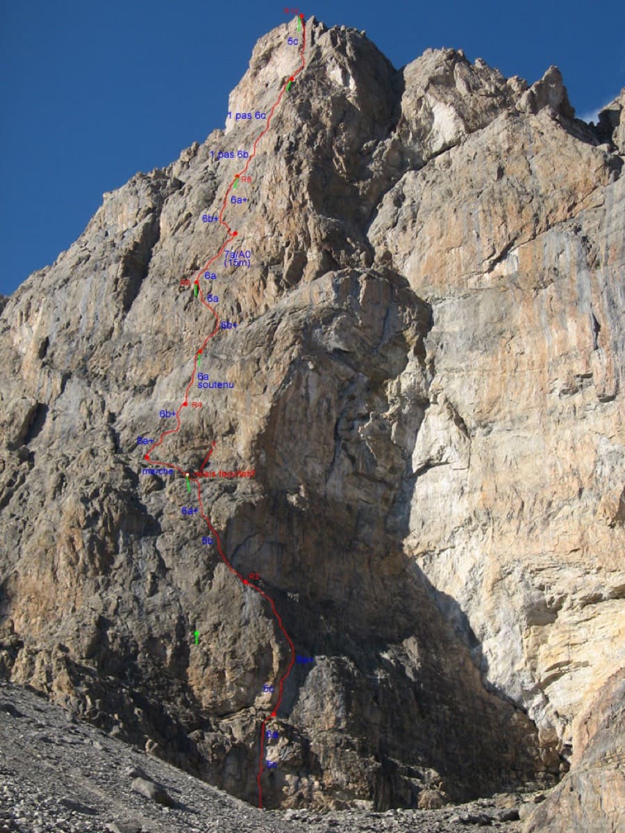
Photo-topo of Feu Sacré on the south-west face of the Tour Termier

France · Cerces

Feu Sacré

The classic hard route of the Tour Termier: ten steep, technical pitches on superb compact limestone at 3000 m, a short walk from the Col du Galibier road. It is never athletic but sustained at 6a+ to 6b, with a 7a pitch and a 6c move that both go at 6a A0. Cold, wind and thin footwork make it feel bigger than the numbers.

7a10 pitches320 m

Local words

At the crag and in town

French

corde
rope
dégaine
quickdraw
spit, goujon
bolt
plaquette
bolt hanger
relais
belay, anchor
Sec !
Take!
Du mou !
Slack!
Avale !
Take in!

France

Other regions nearby