Multipitch Atlas

Salamander

Chlys Öugstchummuhorn (Klein Augstkummenhorn) – south-east face · Wiwanni (Baltschiedertal) · Switzerland

Easy to bailBolting confidence: high

Eight short pitches of 4b to 5a on compact, grippy gneiss slabs above the Wiwannihütte, finishing on a 2880 m summit. Pitches 3 and 4 climb a big steep slab that is the heart of the route. Chained belays and an abseil descent make it the gentlest introduction to the Wiwanni routes, though the starting pitches feel stiff for 4b.

Hardest pitch
5a
Pitches
8
Length
180 m
Approach
60 min
Aspect
SE
South-east-facing
Rope
1×50 m

The route

Overview

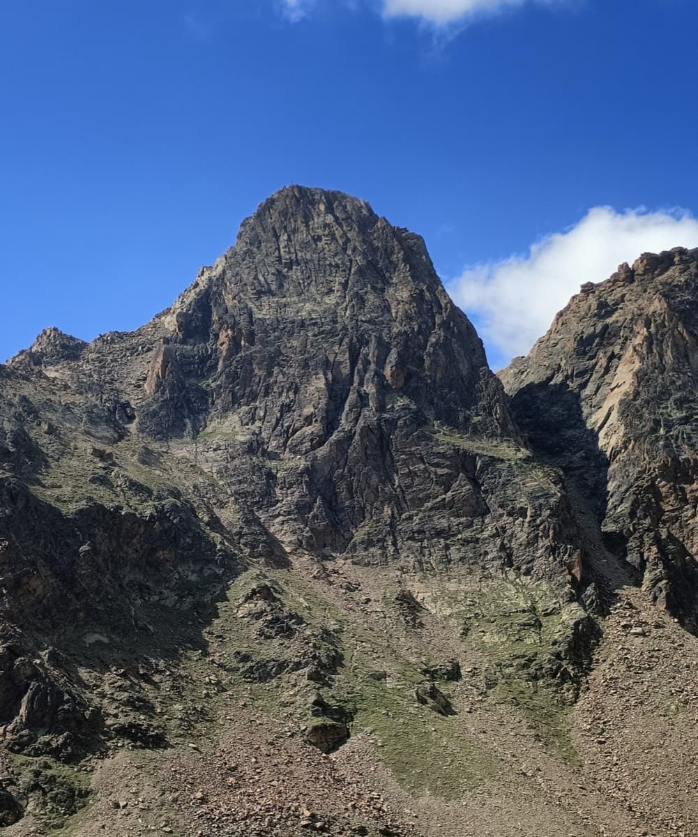
Salamander climbs the south-east face of the Chlys (Klein) Öugstchummuhorn, the lower rock peak south-west of the Wiwannihorn. It has eight pitches between 4b and 5a, except the fifth, which is low-angled and easy; the third and fourth take a large steep slab on superb rock. The pitches are short and can all be linked in pairs with a 50 m rope. A last easy piece of ridge leads to the summit. Parties repeatedly say it is not to be underrated: the first pitch, given 4b, is often called the crux, and one party found the first two pitches nearer 5a.

The climbing

Pitch by pitch

Pitches of Salamander
PitchGradeNotes
P1–Given 4b. After an easy step the line trends up and left to the belay, passing bolts about 5 m left of the stance; there seem to be two starts that join shortly before the belay. Often called the hardest pitch of the route. The first stance is exposed.
P2–Between 4b and 5a; one party thought the first two pitches were both about 5a.
P3–The big steep slab on excellent rock.
P4–The slab continues; pitches 3 and 4 link into one even 40 m pitch.
P5–Low-angled and easy. The first bolt above the fifth belay is hard to see: it is on the bulge just above the stance.
P6–Between 4b and 5a.
P7–Between 4b and 5a.
P8–Between 4b and 5a, to the eighth belay; an easy piece of ridge leads on to the summit.

Getting there

Approach

To the parking

Take the train to Ausserberg (Lötschberg mountain line) or drive there from Visp. From the station the hut is a 4 h 30 walk. Most people drive or take a taxi-bus up the forest road to Fuxtritt (1851 m), which saves 900 m of ascent and leaves about 1 h 30 on foot to the Wiwannihütte (2470 m). The road needs a permit: 5 CHF for the first day and 3 CHF for each further day, from the village shop, the parking machine in the upper village, or by app; parties report 100 CHF fines for not paying. Parking at Fuxtritt is very limited (park on the verge above the timber yard and keep the turning place clear), and camping or sleeping in vehicles is banned throughout the commune.

On foot · about 60 min

From the Wiwannihütte take the path north-west towards the Öugstchummuhorn, following cairns to the base of the Chlys Öugstchummuhorn. You pass below a large, obvious couloir and then reach, one step further north, a deep-cut couloir that is hidden until you are at it (the route Enzian starts here). Go up this couloir for 20 m to the start: the name is painted large in blue and the bolts are visible. Parties take between 45 minutes and 1 h 10 from the hut. Read this carefully: a 2020 party went up the wrong couloir.

Map of the walk-in

  • Crag
  • Parking

Loading map

The point marks the crag, not the exact start of the route.

Coordinates · crag

46.34863, 7.85142

Parking

46.32941, 7.85531

Fuxtritt, 1851 m (camptocamp waypoint 240991): end of the Ausserberg toll road, about 1 h 30 below the Wiwannihütte

Point from camptocamp waypoint 40640 (Klein/Chlys Öugstchummuhorn summit; the route finishes here). It agrees with the high point of the GPS track attached to the camptocamp route.

For your phone or watch

Download GPX

Contains the route point and parking. Opens in most mapping apps and GPS watches.

Points are compiled from published sources, with the precision stated above. They were not surveyed on the ground: check them against a current topo.

Getting down

Descent

Two options. By abseil: camptocamp describes 8 abseils down the route with a 50 m rope, and since 2020 parties have used a newer line that starts just below the summit, away from the routes, in 7 abseils of 25 m; a 2024 party describes it as 4 abseils. The abseils end in the couloir, where stones are easily dislodged. On foot: follow the WSW ridge (a few moves of II to III, some bolts in place), then come back east to one of the two couloirs of the approach; a 2021 party who left the ridge early found steep grass and scree and did not enjoy it.

Retreat

Bailing off the route

Easy to bail

Abseiling is a normal way down and every belay is chained. The pitches are short enough that a single 50 m rope reaches from stance to stance.

Retreat from
Any belay.
Point of no return
None.
Carry
A 50 m rope. Take care with loose stones when you land in the couloir.
Basis
Stated in the sourcesCamptocamp: chained belays and '8 abseils down the route with a 50 m rope'.

Safety

Hazards

  • Stonefall in the approach and descent couloirs, including where the abseils land.
  • Snow in the couloir early in the season; ask the hut warden about conditions and whether an ice axe is needed.
  • The grades are old-school: do not expect the 4b start to be a warm-up.
  • The descent on foot involves exposed scrambling on the ridge and loose gullies.

Sun and weather

Conditions

South-east facing, finishing at 2880 m, in the sun from early morning and all day in late August. Season roughly July to September; the hut website warns that approaches and descents can cross steep snowfields early in summer. In early July 2021 the approach was still under snow and a party used a dry spur to the right for the last 10 m; by late July 2022 the sector was snow-free.

Usual season · Jul to Sep

Sun on the wall · SE-facing

Working out the sunlit hours for this month.

  • January: not yet worked out
  • February: not yet worked out
  • March: not yet worked out
  • April: not yet worked out
  • May: not yet worked out
  • June: not yet worked out
  • July (usual season): not yet worked out
  • August (usual season): not yet worked out
  • September (usual season): not yet worked out
  • October: not yet worked out
  • November: not yet worked out
  • December: not yet worked out

Sun on the wallDaylight, wall in shade● Usual season

Estimated from the wall's aspect only. Ignores surrounding terrain, gullies and the wall's exact shape. Clock times are local to the wall (Central European time), for the 15th of each month.

Climate figures for Wiwanni (Baltschiedertal) are not available yet

What to carry

Gear

10 quickdraws and a 50 m rope; extend a few quickdraws if you link pitches. Helmet. No cams or nuts.

Checklist

Quickdraws
10
Rope
1×50 m
Helmet
One each
Abseil device and prusik
The descent or the retreat involves abseiling

Derived from the route data; check it against a current topo

From climbers

Reader reports

Reader reports are not being collected yet. Until they are, check a current topo and the local club or guidebook publisher for recent changes to Salamander.

Worth knowing

Tips

  • The Wiwannihütte is the base (half board 67 CHF in 2024; no drinking water on tap, so parties buy bottles or treat the fountain water). In 2026 it was wardened until 18 October.
  • Allow about 2 h 15 to 2 h 30 for the climb and up to 2 hours for the abseils with a party of two ropes.
  • It fits an afternoon after walking up to the hut, leaving the Wiwannihorn for the next day.
  • The hut sells a topo; it is also in the Plaisir West guide.

Open questions

Where sources disagree

  • Abseils: 8 down the route (camptocamp), 7 of 25 m on the newer line (2020 reports), '4 abseils with a 50 m rope' in a 2024 report, which probably means two ropes.
  • Per-pitch grades are not published on camptocamp, only the range 4b to 5a; parties disagree with the official order of difficulty, finding the 4b first pitch harder than the 5a.

Provenance

Sources

Same area

More in Wiwanni (Baltschiedertal)

All routes in Wiwanni (Baltschiedertal)
The Wiwannihorn from near the hut; the east ridge is the right-hand skyline

Switzerland · Wiwanni (Baltschiedertal)

Ostgrat (East Ridge)

A 17-pitch bolted ridge to a 3001 m summit. Three slab and wall pitches of 5a and 5b come first, then a long run of grade 3 and 4 on the crest that many parties climb moving together, with one fine 5a in the middle. A full mountain day: the summit ridge beyond the last bolt and the scrambling descent are part of it.

5b17 pitches400 m

Read the cautions
Around 5a · about 8 pitches

Similar elsewhere

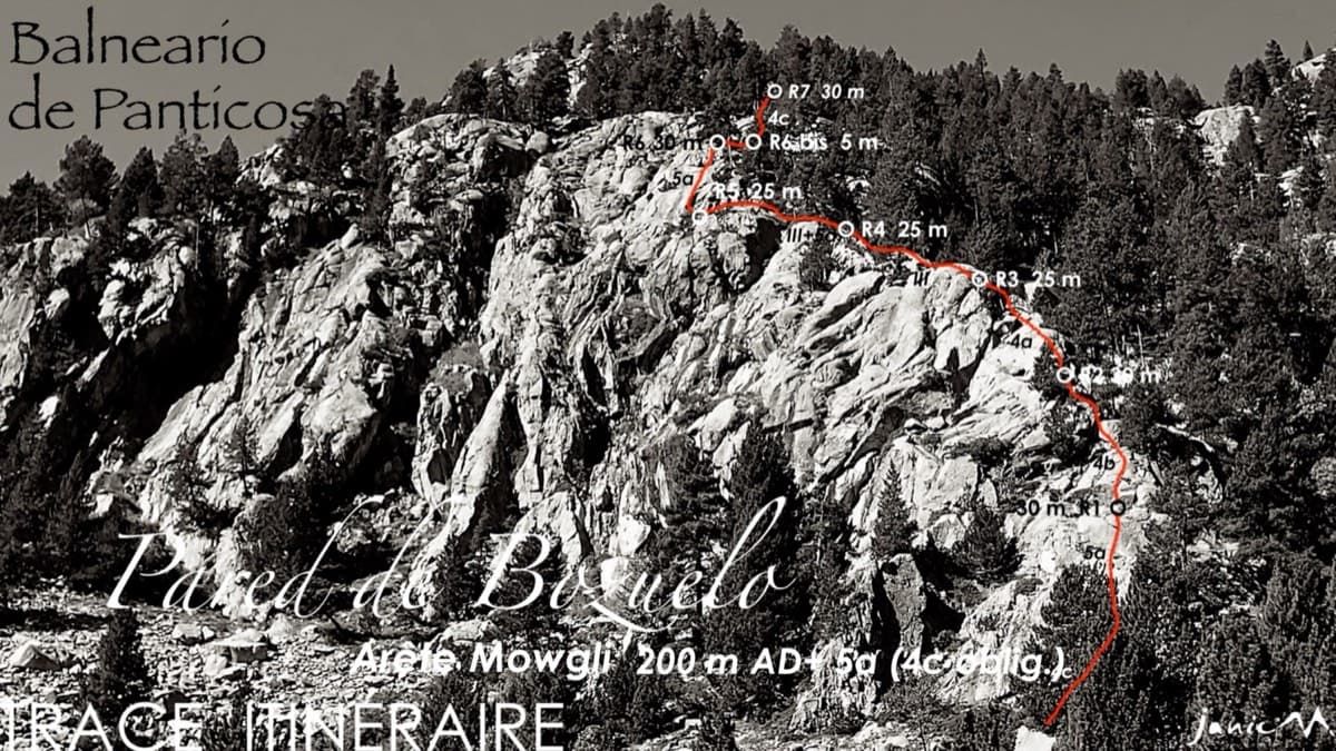
Line of the Arista Mowgli on the Pared de Bozuelo above Baños de Panticosa, with belays marked

Spain · Aragonese Pyrenees (Tena & Canfranc valleys)

Arista Mowgli

An easy granite ridge above the Bozuelo meadows, low-angled and never exposed. Two smooth friction slabs at 5a, on pitches 1 and 6, are the only real difficulties; the rest is steps and short walls at grade 3 to 4. Ideal for a first multipitch, and you can step off rightwards onto ledges almost anywhere.

5a7 pitches200 m

The Schneekar and the north side of the Treffauer, where the route climbs the lower rocks beside the normal route

Austria · Wilder Kaiser

König der Löwen

Nine pitches of easy slabs and water runnels beside the Treffauer normal route, UIAA 5 at most if you take the easy variant on pitch 4. Lots of bolts and friendly ground make it one of the most popular routes in the Schneekar. The rock is not solid everywhere and the walk-in is two hours.

5a9 pitches280 m

The Röthelstein near Mixnitz

Austria · Grazer Bergland

Strauchdieb

A new (2025) nine-pitch outing on the right edge of the Breite Wand that weaves between the bushes. Three spots of UIAA 5-/5, otherwise easier. Still a little earthy in places.

5a9 pitches260 m

The Jegihorn south face from the approach; Panorama is the right-hand route on the face

Switzerland · Saas Valley

Panorama

The right-hand of the Jegihorn's three easy bolted routes and the quietest. Ten long pitches up low-angled slabs and then a steeper, airy central section on sharp flakes and edges, finishing along a short crest to the 3206 m summit. Bolts are further apart than on Alpendurst and the belays are unlinked, so it suits a leader who is steady at 4c.

5a10 pitches360 m

Read the cautionsCommitting

Compiled from published sources and last verified October 2026. Bolts, anchors and access change. Climbing is dangerous and you are responsible for your own decisions: check a current topo and read the disclaimer.