Multipitch Atlas

Il Gatto e la Volpe

Pilier Franco Salluard (Val Ferret, Courmayeur) · Aosta Valley · Italy

Easy to bailBolting confidence: high

Rated 'great' on camptocamp: a wild setting with a short, easy approach from Lavachey. It climbs edgy granite slabs and a pillar crest, with a three-star exposed slab on P9.

Topo of Il Gatto e la Volpe on the Pilier Franco Salluard, Val FerretPhoto: herve thivierge · CC BY-SA 3.0

Topo

Topo of Il Gatto e la Volpe on the Pilier Franco Salluard, Val FerretPhoto: herve thivierge · CC BY-SA 3.0
Hardest pitch
6a+
Pitches
11
Length
350 m
Approach
20 min
Aspect
S
South-facing
Rope
1×70 m

The route

Overview

Il Gatto e la Volpe climbs the Pilier Franco Salluard, a granite pillar on the Frébouze slabs above Lavachey in the Italian Val Ferret. It has 11 pitches and about 350 m: edgy slabs low down, then steeper walls, a small overhang and a pillar crest, with two short walking links. The key pitch is P3, a long, thin and sustained 6a+ slab. Since the 2017 rebolt the equipment is described as solid and well thought out, and the approach is only about 20 minutes, so it is a relaxed day in a quiet, wild setting. Expect three pitches of 6a+ with 5c obligatory.

In pictures

Photos

Approach photo

The climbing

Pitch by pitch

Pitches of Il Gatto e la Volpe
PitchGradeLengthBoltsNotes
P14a15 m–Up a corner to a stop, then traverse 7 m left to belay R1. Gulliver gives 25 m.
P25c25 m–A fine slab on small edges. Reported hard for the grade, with one thin move.
P36a+35 m14 boltsThe key pitch: a superb slab trending right, long, delicate and sustained. 14 bolts, not counting the directional. The crux comes after the third bolt.
P45b20 m–One hard move, then slab to R4.
P56a+––An awkward overhang, turned on the left, then slab to R5. Gulliver gives 6a/6a+.
P65b––Link pitch to the base of the pillar crest, with one rock step.
P75c––Up the crest of the pillar. R7 is an intermediate belay; with a 70 m rope you can run on to R8.
P85b––Continue up the crest to R8, then walk on to the two trees at the foot of the last wall, where belay R8' is. With a 50 m rope you cannot reach R8' in one go.
P96a+––A good slab, an exposed passage out right through a bulge, and the exit to R9.
P106a––A slab on good edges and a corner to R10.
P115c––A slab with some lichen to the final belay R11. One party thought it not worth doing if short of time.

Getting there

Approach

To the parking

From Courmayeur drive up Val Ferret through La Palud and Planpincieux to Lavachey. Park in the small car park (about 20 spaces) on the left just before the bridge leading to the Lavachey chalets, or in the larger roadside car park before the Pont de Frébouze. Parking is pay-and-display (16 € for the day reported in June 2026). Only official car parks may be used; campervans must stop at Pra Sec, 1 km before Lavachey, and vans have been fined here. From late July to late August the road is closed above the Pont de Frébouze from 9:00 to 16:00. A seasonal bus runs from Courmayeur. The road is closed from Planpincieux in winter.

On foot · about 20 min

About 20 min. From the car park follow the dirt track for 300 m to a left turn towards a concrete water-intake outlet. Go up above it for 50 m to a small cairn on a big boulder. Follow the cairned path that leads towards the Frébouze slabs to roughly half height, then cross the dry stream bed leftwards (small cairns) to the start. A 2026 party had to wade a shallow boggy patch on the way. The line is clearly visible from the approach.

Finding the route · 1 photo

  • OverviewThe wall seen from the scree on the approach. The blue line is the neighbouring route Lockdown, which starts about 100 m left of Il Gatto e la Volpe.Photo: JACOPO88 · CC BY-SA 3.0

Approach photo

Map of the walk-in

  • Crag
  • Parking
  • GPS line

Loading map

The point marks the crag, not the exact start of the route.

GPS line: one party's recorded GPS track of the whole day, including the climb and the descent. One party's recorded day in July 2026, arriving by bus: walk-in from Lavachey, the lower part of the climb and the return. The track's high point is about 400 m from the crag point shown on the map. Do not follow it blindly.

GPS line: lipsum, adrieD · CC BY-NC-ND 3.0

Coordinates · crag

45.85327, 7.01323

Parking

45.85304, 7.02517

Lavachey / Pont de Frébouze (camptocamp access point)

Point from camptocamp waypoint 790072

For your phone or watch

Download GPX

Contains the route point, parking and a GPS line. Opens in most mapping apps and GPS watches.

Points are compiled from published sources, with the precision stated above. They were not surveyed on the ground: check them against a current topo.

Getting down

Descent

Abseil the route from the bolted belays. Gulliver and the Spanish Camptocamp text say a single 70 m rope is enough. The last two abseils are offset to the right of the line of ascent. Parties describe the abseils as a bit laborious, with wind and vegetation; one party took 1.5 h.

Retreat

Bailing off the route

Easy to bail

Yes. Abseiling the route is the normal descent, and the belays are bolted and equipped for it. A single 70 m rope is enough. Parties find the abseils a bit slow because of wind and vegetation, and the last two are offset to the right of the climbing line.

Retreat from
Any belay. Between R8 and R8' there is a walk along a ledge to two trees, which you reverse on foot. One report suggests stopping below the top if you are short of time, as the last pitch adds little.
Carry
1×70 m rope and an abseil device.
Basis
Stated in the sourcesGulliver and camptocamp state the abseil descent on a single 70 m rope; trip reports add the wind and vegetation.

Safety

Hazards

  • Gulliver notes that even after the rebolt (30+ bolts added) the bolting is not closely spaced; 5c is obligatory and one party felt that understated for P3.
  • Abseils can snag: wind and vegetation make the descent awkward.
  • Parking rules are enforced: parties were fined in June 2026 (58 € for a van despite paying), and the road is regulated in high summer.
  • Lichen on the last pitch.

Sun and weather

Conditions

South facing; the base is at about 1,800 m. Summer route: trip reports run from late May to early September, and the valley road is closed in winter. Dries fast: dry the day after rain, and P3 dried quickly after a shower. Often windy and cold higher up. Mosquitoes can be vicious at the base. Usually quiet, though one July 2026 party met four other teams.

Usual season · Jun to Sep

Sun on the wall · S-facing

Working out the sunlit hours for this month.

  • January: not yet worked out
  • February: not yet worked out
  • March: not yet worked out
  • April: not yet worked out
  • May: not yet worked out
  • June (usual season): not yet worked out
  • July (usual season): not yet worked out
  • August (usual season): not yet worked out
  • September (usual season): not yet worked out
  • October: not yet worked out
  • November: not yet worked out
  • December: not yet worked out

Sun on the wallDaylight, wall in shade● Usual season

Estimated from the wall's aspect only. Ignores surrounding terrain, gullies and the wall's exact shape. Clock times are local to the wall (Central European time), for the 15th of each month.

Monthly climate averages for Aosta Valley, 1991-2020
MeasureJanFebMarAprMayJun (usual season)Jul (usual season)Aug (usual season)Sep (usual season)OctNovDec
Mean daily high °C−20371117202016103−1
Mean daily low °C−8−8−5−148111172−4−8
Rain days 1 mm or more121112131616151312121312

● marks the usual climbing season. Averages for 1991-2020 at about 1489 m. Area climate from Open-Meteo reanalysis. Temperatures are adjusted to the height of the crag; rain comes from a grid cell of about 10 to 25 km, and summer highs on sea cliffs can read a few degrees low. The wall and valley can differ. Data: Open-Meteo, CC BY 4.0.

What to carry

Gear

70 m single rope, 15 quickdraws (P3 has 14 bolts), abseil device. Helmet.

Checklist

Quickdraws
15
Rope
1×70 m
Helmet
One each
Abseil device and prusik
The descent or the retreat involves abseiling

Derived from the route data; check it against a current topo

From climbers

Reader reports

Reader reports are not being collected yet. Until they are, check a current topo and the local club or guidebook publisher for recent changes to Il Gatto e la Volpe.

Worth knowing

Tips

  • With a 70 m rope you can link P7 to R8; with 50 m you cannot link R8 to R8' and may need an intermediate belay on the ledge.
  • Odd pitches (3, 5, 9) get the three 6a+ leads if you swing leads.
  • You can stop below the top without missing much: the final pitch is the least interesting.
  • A good choice in uncertain weather because of the short approach and abseil descent.
  • The restaurant at Lavachey is recommended by several parties.

Open questions

Where sources disagree

  • P1 length: 15 m (Camptocamp) versus 25 m (Gulliver).
  • Middle pitches: Camptocamp FR puts the overhang on P5 (6a+) and the link on P6; Gulliver agrees on grades (5b, 6a/6a+, 5b) but describes the small overhang as part of the link pitch too. The Camptocamp ES text shifts the descriptions by one pitch. Grades followed here are the same in all three.
  • First ascent: Camptocamp lists 1998 for the opening; Gulliver clarifies that only the first six pitches date from 1998 and the full route from 2015.
  • Approach time is given only by Gulliver (20 min); a 2026 party took 35 min from car to starting to climb.

Provenance

Sources

Same area

More in Aosta Valley

All routes in Aosta Valley
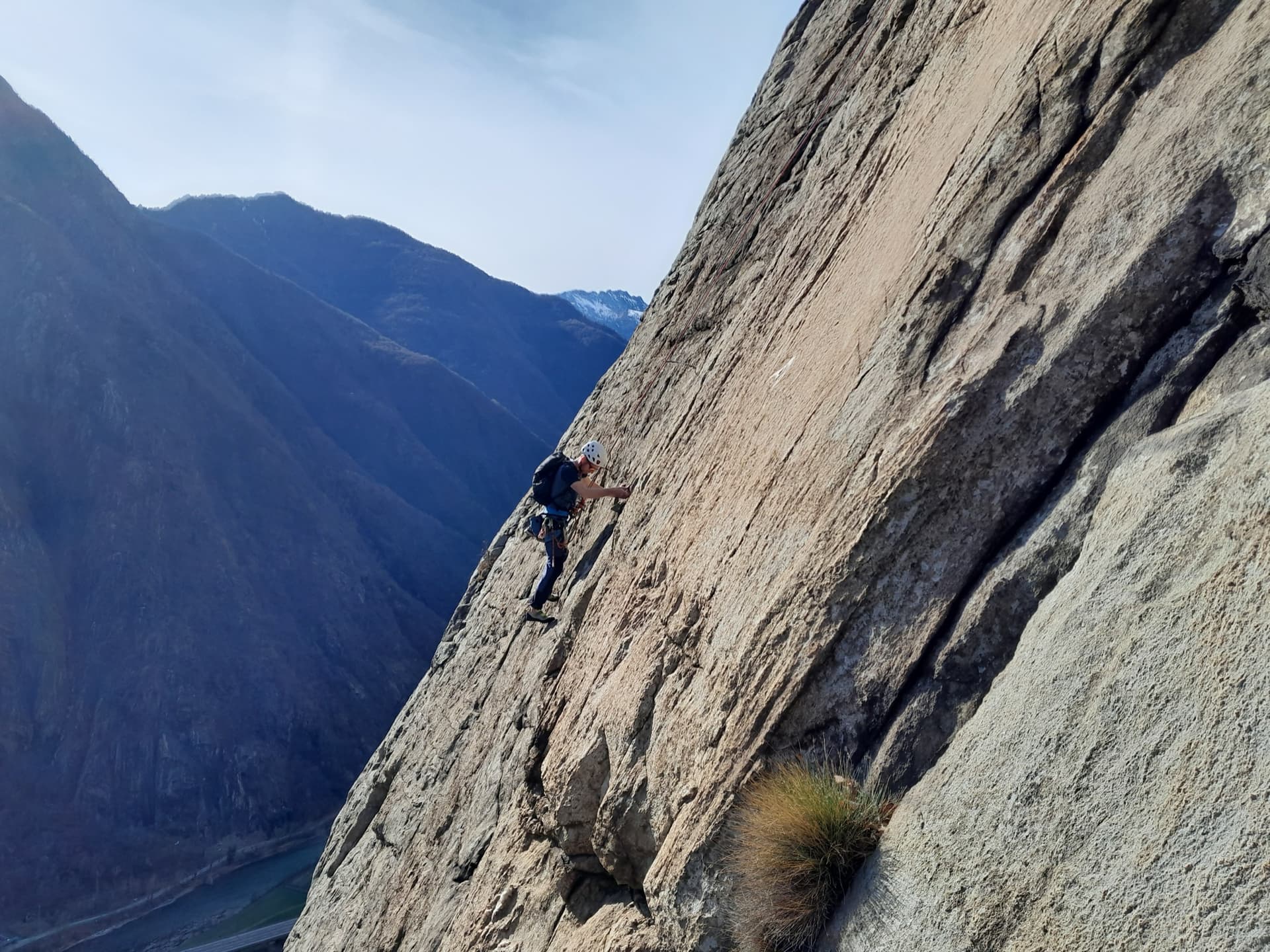
A climber on the sweeping gneiss slab of Bucce d'Arancia on the Paretone di Arnad (Corma di Machaby), with the Dora Baltea valley in shadow far below.

Italy · Aosta Valley

Bucce d'Arancia

This is the most-climbed route on the Paretone. It gives sustained, varied slab and crack climbing on good gneiss, and the hardest moves are a fine crack on P2, a slanting corner and a punchy wall. Queues are common on good days. The Mani Nude guidebook grades it stiffly; camptocamp's Italian page calls it sustained at 5b–5c+ with a single 6a.

6a10 pitches290 m

Read the cautions
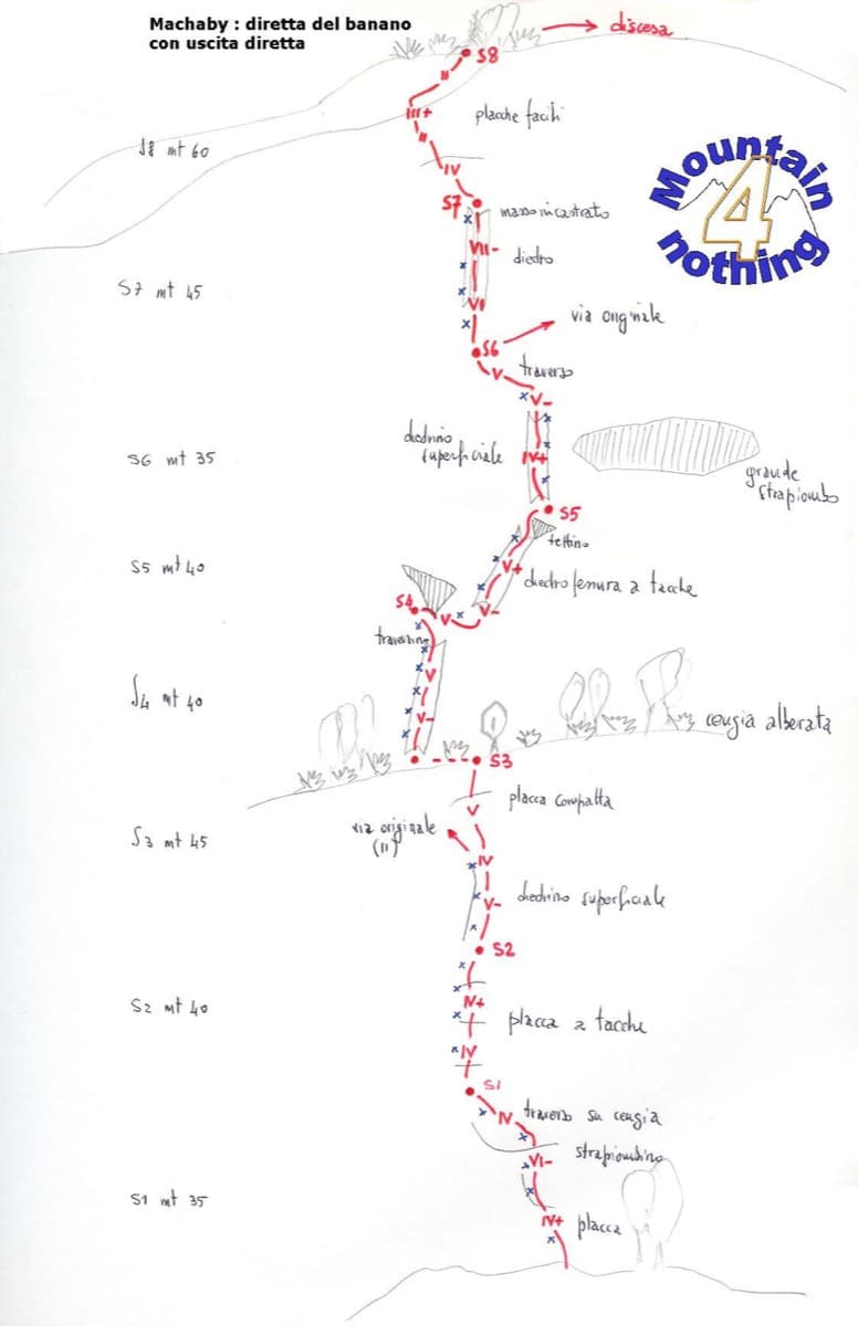
Hand-drawn topo of Diretta al Banano (direct finish), Corma di Machaby

Italy · Aosta Valley

Diretta al Banano

Along with Bucce d'Arancia this is the Paretone's other great classic (first ascent 1977, later retro-bolted). It climbs big, juggy, non-athletic slabs on beautiful rock up the centre of the wall to near the summit. Expect a few metres above the last bolt in places.

5c+9 pitches250 m

Read the cautions

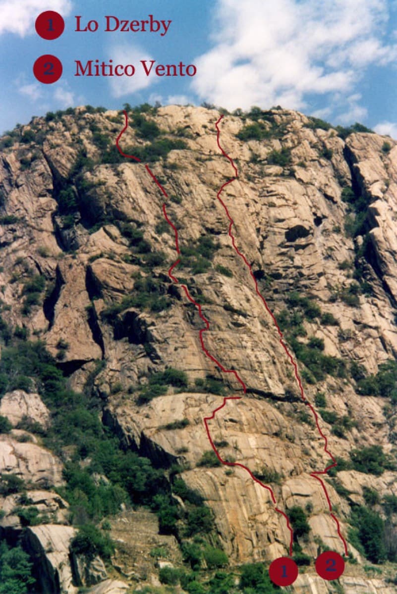
Topo of Lo Dzerby (line 1) and Mitico Vento on the Corma di Machaby, Arnad

Italy · Aosta Valley

Lo Dzerby

A long, easy-angled outing up the full height of the Paretone. A steeper lower half with an exposed pillar on P5 leads to sculpted slabs and broken steps higher up. It's a good first big multipitch.

5c13 pitches400 m

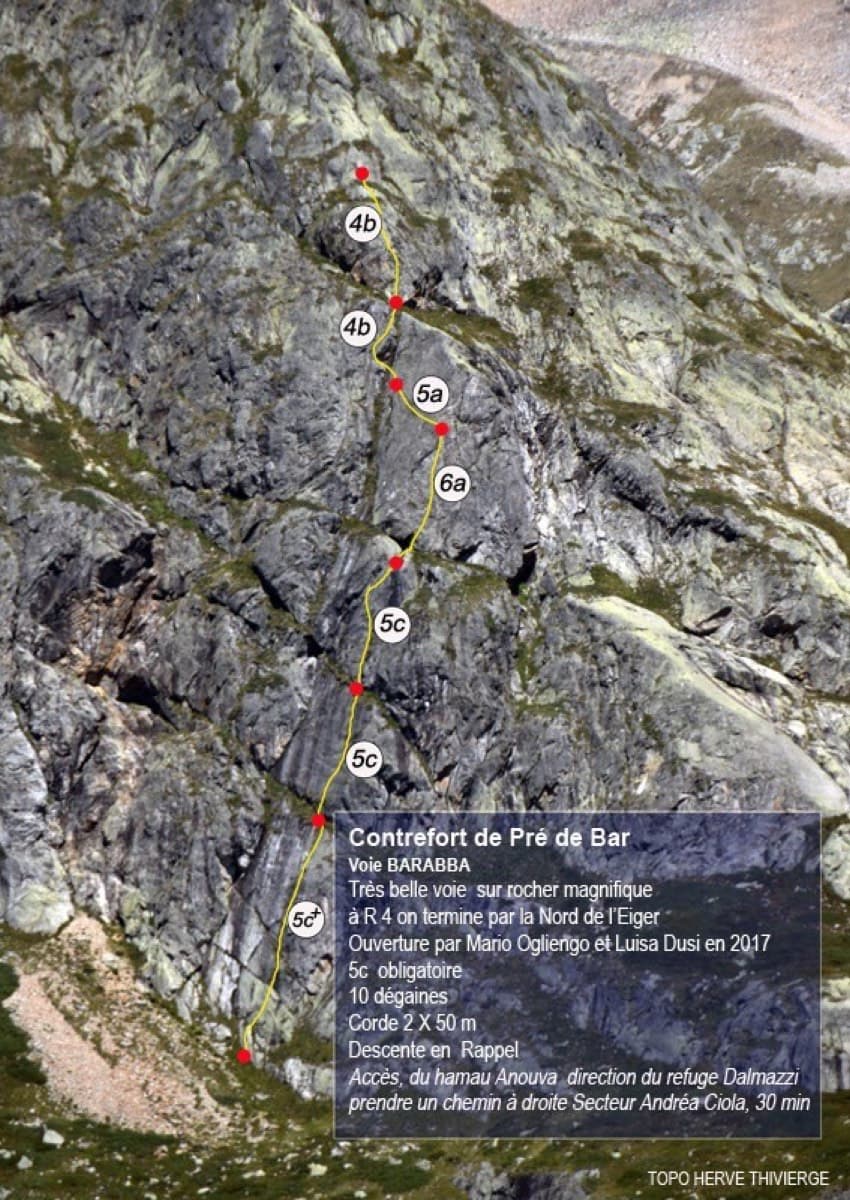
Topo of Barabba on the Contrefort de Pré de Bar, Val Ferret

Italy · Aosta Valley

Barabba

A pretty plaisir route on edgy, quartz-studded granite slabs beneath the Mont Blanc massif. The crux is a short bulge and steep juggy wall on P4. Camptocamp rates it 'great'.

6a7 pitches180 m

Around 6a+ · about 11 pitches

Similar elsewhere

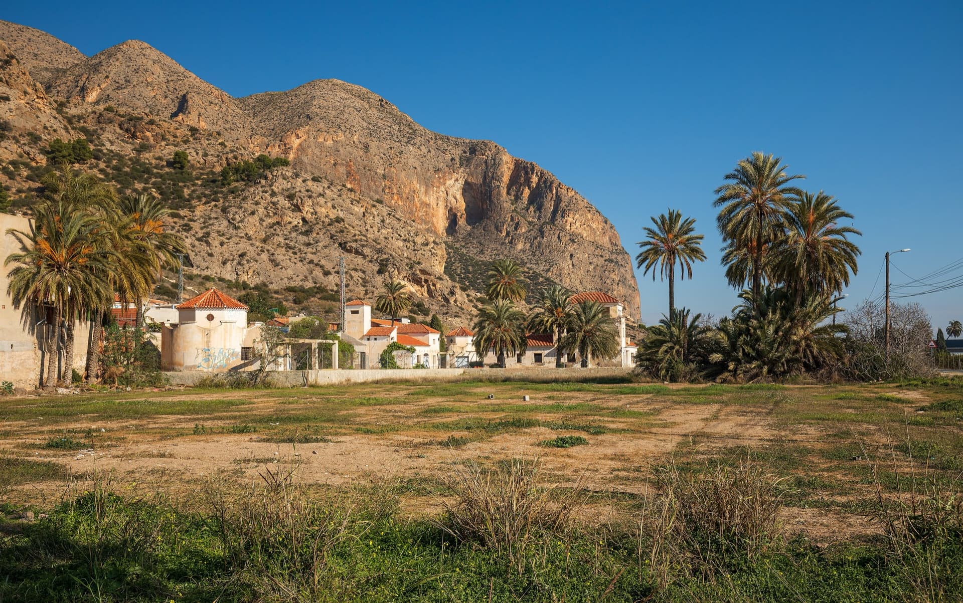
The big orange limestone wall of the Sierra de Callosa directly above Redován, seen from the edge of the village.

Spain · Vega Baja (Orihuela & Callosa)

Botri

The classic of Redován: ten pitches and 300 m of steady grade 5 with three steeper pitches on red rock. The eighth pitch, a traverse right into an overhanging corner above the orange cliffs, is the one people remember. Closed from January to June for nesting eagles.

6a+10 pitches300 m

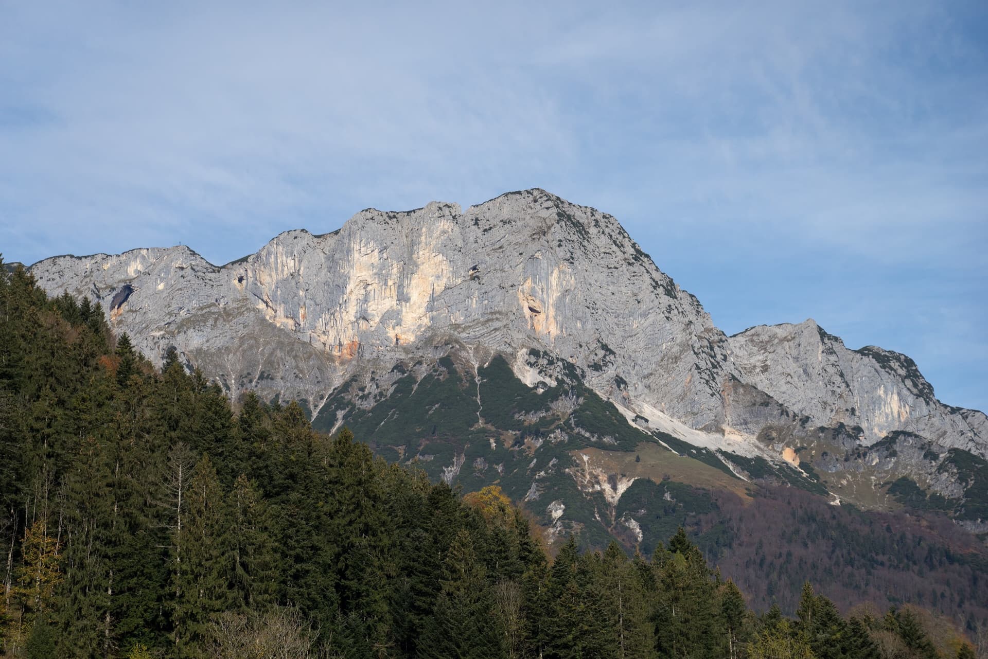
The Berchtesgadener Hochthron, highest point of the Untersberg, seen from Maria Gern: the south face in afternoon light, with the south-east walls on the right.

Germany · Berchtesgaden & Bad Reichenhall

Dahoam is Dahoam

A long-day alpine-flavoured plaisir route on the Untersberg's summit wall. Pitches range from UIAA 5+ to 6+ (≈5b–6b), with 5+ obligatory.

6a+10 pitches250 m

The twin limestone summits of Peña Foratata above the forest, seen from Sallent de Gállego in spring.

Spain · Aragonese Pyrenees (Tena & Canfranc valleys)

La Joya del Gállego

Varied, sustained limestone of chimneys, dihedrals and compact fluted slabs high above the Tena valley. Bearded-vulture nesting closes the face from 1 Dec to 31 Jul unless lifted early, so check montanaregulada.org.

6a+10 pitches265 m

Read the cautions

View west along the Inn valley from the top of the Geierwand near Haiming, with part of the wall on the right

Austria · Inntal (Haiming Geierwand)

Sunset Boulevard

Billed as probably the best mid-grade multipitch at the Geierwand (UIAA 6/6+, 5 obligatory). It starts with steep, juggy climbing, and the upper pitches are rough pocketed slabs. It can be combined with Alhambra's upper pitches.

6a+12 pitches345 m

Compiled from published sources and last verified October 2026. Bolts, anchors and access change. Climbing is dangerous and you are responsible for your own decisions: check a current topo and read the disclaimer.