Multipitch Atlas

Pink Floyd

Dent d'Orlu – East Face · Ariège Pyrenees · France

Read the cautionsBail with caveatsBolting confidence: high

Consistent, low-angled slab climbing on compact granite, with 10 pitches of 5a–5b+ on the big east face. Above all it is a long, sunny-morning moderate.

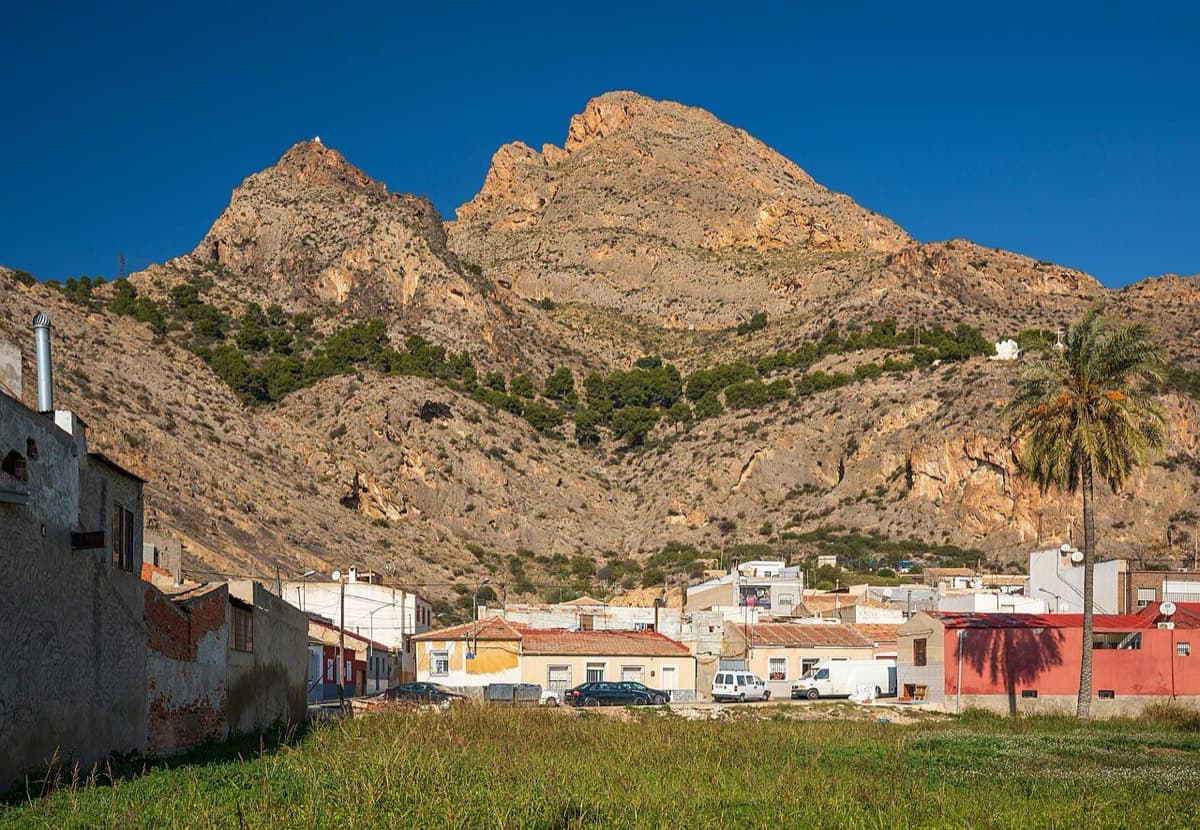
East face of the Dent d'Orlu (lower part), seen from the approach pathPhoto: Yayo · CC BY-SA 3.0

Photo

East face of the Dent d'Orlu (lower part), seen from the approach pathPhoto: Yayo · CC BY-SA 3.0
Hardest pitch
5b+
Pitches
10
Length
400 m
Approach
75 min
Aspect
E
East-facing
Rope
1×50 m
single 50 m rappel from the grass ledge if retreating
Read before you go

Fully bolted with ring belays, but the bolts are spaced on slab and the last 4c pitch has only 2, so it needs a leader comfortable running it out at 5b.

The route

Overview

Pink Floyd is a 10-pitch slab route up the east face of the Dent d'Orlu (2222 m), climbing between about 1850 m and the summit on compact granite. The climbing is very even, almost all friction and footwork at 5a to 5b+, with one slightly steeper step near the top. It was opened in 2006 as a semi-equipped mountain route with 60 m pitches and is now climbed as 10 bolted pitches. Parties describe the bolts as sound but spaced, so you climb between them, and the day is long: 1 h 15 walk-in, 3 to 4 h 30 of climbing and about 800 m of descent on foot.

The climbing

Pitch by pitch

Pitches of Pink Floyd
PitchGradeLengthBoltsNotes
P15b+35 m–Official start from the grass ledge. Slab. The CAF topo gives 5a+. After rain this lower section seeps and gets slippery.
P25b30 m–Slab. CAF topo: 5b.
P35b40 m–Slab. CAF topo: 5b. A crushed hanger was reported here in 2026 (still clippable).
P45a35 m–Slab. CAF topo: 4c.
P55a30 m–Slab. CAF topo: 4c.
P65a30 m–Slab. CAF topo: 4c.
P75a40 m–About 5 m above the belay, traverse right. Make sure you go right here. CAF topo: 4c.
P85a35 m–Slab. CAF topo: 4c.
P95b+40 m–Slightly right, a small mantel, then a short sharp bulge a little higher. The bolts on the left belong to Fleurs de Rhodo. Bolts reported as more spaced here. CAF topo: 5b.
P104c45 m2 boltsShared with the last pitch of Fleurs de Rhodo. Vegetated; a 2023 party found only 2 bolts on it. Summit belay is not equipped for abseiling.

Getting there

Approach

To the parking

Base is Ax-les-Thermes (N20 towards Andorra). Take the D122 towards Ascou-Pailhères; after the lake at Goulours turn right at the campsite, after 1.2 km turn left and follow the track-road to the turning area known as 'la poêle à frire' (Jasse de Cabane Longue on the IGN map, about 1510 m). Trip reports call the track long and potholed in places; one 2026 party with a low car walked from the Goulours campsite instead (about 2 h 40 to the foot of the route). The car park is large but busy with walkers.

On foot · about 75 min

About 1 h 15. From the car park follow the normal-route path of the Dent d'Orlu. At the foot of the final steepening (signposts) take the path left towards the Col de l'Osque / Col de Brasseil; after about 150 m the east face comes into view. Descend along the foot of the face. Official start: go to the start of 'Tapas sans dalle' and follow the Vire des Isards (grass ledge); Pink Floyd is the first line on the left, with an obvious line of bolts. A 2026 report describes two red dots marking other routes at the start of the ledge, then two minutes further a red dot and the painted name 'Pink Floyd', just above an old belay on rusty hangers. The name was partly faded but legible in 2025; a cairn at the base comes and goes. Alternative: go to the start of 'Fleurs de Rhodo' (name painted in red); Pink Floyd starts on the ledge above, about 10 m to the right (black marking), reached by an optional 65 m 4a lead-in pitch that has little protection.

Finding the route · 3 photos

Approach photo

Map of the walk-in

  • Crag
  • Parking

Loading map

The point marks the crag, not the exact start of the route.

Coordinates · crag

42.69114, 1.94190

Parking

42.70629, 1.93076

Orlu - Jasse de Cabane Longue (camptocamp access point)

Point from camptocamp waypoint 187204

For your phone or watch

Download GPX

Contains the route point and parking. Opens in most mapping apps and GPS watches.

Points are compiled from published sources, with the precision stated above. They were not surveyed on the ground: check them against a current topo.

Getting down

Descent

On foot. From the top go right to the summit of the Dent d'Orlu and descend the normal-route path back to the car park. It is about 800 m of descent in total and the first part is very steep. If you need to retreat, belays are equipped with abseil rings (2023 and 2026 reports), except the summit one; camptocamp mentions a 50 m abseil from the grass ledge.

Retreat

Bailing off the route

Bail with caveats

You can retreat by abseil, but not on the single 50 m rope that is enough for the climb. Trip reports from 2023 and 2026 say the belays have abseil rings, except the summit one, and the pitches are 30 to 40 m long. Retreating from high up means many abseils down a slab between two unlinked bolts each time.

Retreat from
Any belay from R1 to R9 according to the reports of ring belays. The route starts from a grass ledge (the Vire des Isards) that you reach on foot, so once back on the ledge you can walk out the way you came in; camptocamp also mentions a 50 m abseil from the ledge.
Point of no return
None is documented. The summit belay is not equipped for abseiling, and the last pitch is 45 m of vegetated 4c with only two bolts, so from R9 it is a choice between that pitch and nine abseils.
Carry
Two ropes of 45 to 50 m (the CAF topo lists 'rappel 90 m'); a single 50 m rope only gives 25 m abseils and the pitches are 30 to 45 m. Cord or slings to link the two bolts, and a spare maillon in case a ring is missing.
Basis
Part stated, part inferredRing belays and the 50 m abseil from the grass ledge are stated by camptocamp and its trip reports and the 90 m abseil rope by the CAF topo; that a single 50 m rope will not reach between belays and that you can walk off the ledge are inferred from the pitch lengths and the approach description.

Partly inferred from the route facts

Safety

Hazards

  • Bolts are in good condition but spaced on easy slab; leading is not trivial at the grade (2023 and 2024 reports). Pitch 9 is noticeably more spaced and the final 45 m 4c pitch has only 2 bolts.
  • The optional 65 m 4a lead-in pitch below the grass ledge is poorly protected. The official start is from the ledge.
  • In 2026 a party found 2 or 3 loose nuts to tighten and one crushed hanger on pitch 3.
  • Wet slab: the lower pitches seep for a day or more after rain and become much harder.
  • Easy to stray onto Fleurs de Rhodo, which runs just left and is sometimes very close (pitch 9 especially).
  • Belays are mostly hanging or on narrow ledges, on two bolts that are not linked.
  • The descent is long (about 800 m) and steep at the top; late-spring snow patches can affect the approach.

Sun and weather

Conditions

East-facing: the face gets the sun early in the morning and loses it early too. The rock is cold at dawn in October. Summer to early autumn is the season; in late spring snow patches can make the starts awkward. The lower part runs with water after rain because of vegetation: in September 2024 the whole face was soaked and only pitch 1 was climbable, and in October 2023 the bottom was 'a waterfall' the day after rain. Trip reports mention wind and, in August 2025, flying ants on the summit. One October Sunday party found it surprisingly quiet.

Usual season · Jun to Oct

Sun on the wall · E-facing

Working out the sunlit hours for this month.

  • January: not yet worked out
  • February: not yet worked out
  • March: not yet worked out
  • April: not yet worked out
  • May: not yet worked out
  • June (usual season): not yet worked out
  • July (usual season): not yet worked out
  • August (usual season): not yet worked out
  • September (usual season): not yet worked out
  • October (usual season): not yet worked out
  • November: not yet worked out
  • December: not yet worked out

Sun on the wallDaylight, wall in shade● Usual season

Estimated from the wall's aspect only. Ignores surrounding terrain, gullies and the wall's exact shape. Clock times are local to the wall (Central European time), for the 15th of each month.

Monthly climate averages for Ariège Pyrenees, 1991-2020
MeasureJanFebMarAprMayJun (usual season)Jul (usual season)Aug (usual season)Sep (usual season)Oct (usual season)NovDec
Mean daily high °C225812161919151263
Mean daily low °C−6−6−4−1379963−2−5
Rain days 1 mm or more111212151817171713121211
Sunshine hours a day7.18.510.010.811.612.412.912.110.48.97.46.8

● marks the usual climbing season. Averages for 1991-2020 at about 1785 m. Area climate from Open-Meteo reanalysis (about 10 km grid): the wall and valley can differ. Data: Open-Meteo, CC BY 4.0.

What to carry

Gear

Camptocamp: 9 quickdraws and 3 slings, plus small cams and micro-nuts 'for morale' (optional). The CAF Ariège topo lists 8 quickdraws plus belay kit and an abseil rope ('rappel 90 m'). A 2025 party reports a 50 m rope is enough. Belays are two unlinked bolts, so bring slings to build them. Helmet.

Checklist

Quickdraws
9
Rope
1×50 m (single 50 m rappel from the grass ledge if retreating)
Helmet
One each
Abseil device and prusik
The descent or the retreat involves abseiling
Slings
Mentioned for retreat
Maillons or spare karabiners
To leave behind if you retreat
Cord
Mentioned for retreat

Derived from the route data; check it against a current topo

From climbers

Reader reports

Reader reports are not being collected yet. Until they are, check a current topo and the local club or guidebook publisher for recent changes to Pink Floyd.

Worth knowing

Tips

  • Trip reports say the camptocamp grades are more realistic than those in the printed guide or on the CAF site, which are roughly a grade lower.
  • Start early to climb in the sun; the face goes into shade early.
  • A spanner is worth carrying given the loose nuts reported in 2026.
  • Neighbouring routes of similar style on the same face (Tapas sans dalle, Les Dalles blanches, Fleurs de Rhodo) make a good multi-day stay; Goulours has a campsite.
  • Allow 3 h to 4 h 30 for the climb.

Open questions

Where sources disagree

  • Grades: camptocamp gives 5b+, 5b, 5b, 5a x5, 5b+, 4c; the CAF topo gives 5a+, 5b, 5b, 4c x5, 5b, 4c (max 5b, 5a obligatory). This entry follows camptocamp, which recent parties call the more realistic.
  • Length: camptocamp 400 m of difficulties; CAF topo 350 m (its pitch lengths add up to 360 m).
  • Quickdraws: 9 (camptocamp) vs 8 (CAF topo).
  • Bolting: the CAF topo simply says 'équipée' and recent reports say 'very well equipped', while others stress spaced bolts and camptocamp still suggests small cams and micro-nuts for morale.
  • Rope: the CAF topo lists 'rappel 90 m'; a 2025 party says a single 50 m rope is enough. Pitches are up to 45 m.

Provenance

Sources

Same area

More in Ariège Pyrenees

All routes in Ariège Pyrenees
On the slabs of Arabesque, Piliers des Cathares, Calamès

France · Ariège Pyrenees

Arabesque

The hard classic of the Calamès pillars above Bédeilhac: technical slabs, a well-bolted roof and a sustained 6c wall, capped by a short 7a slab pitch after a walk across a garden. Compact rock and close bolts make it a good place to try harder grades on a multipitch. The middle pitch is vegetated.

7a5 pitches180 m
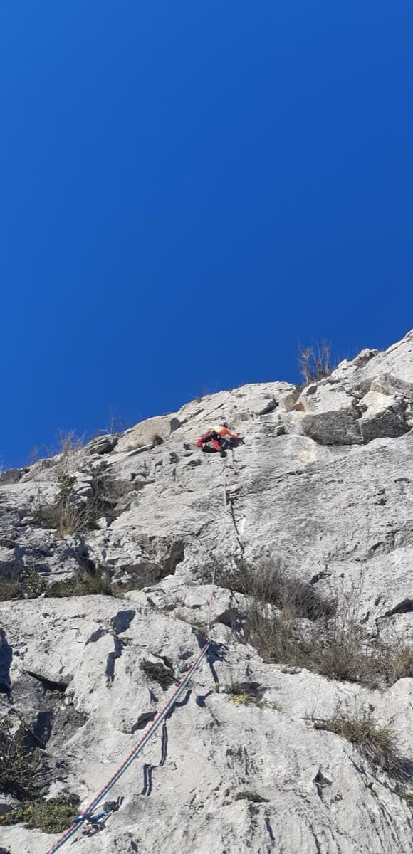
Around 5b+ · about 10 pitches

Similar elsewhere

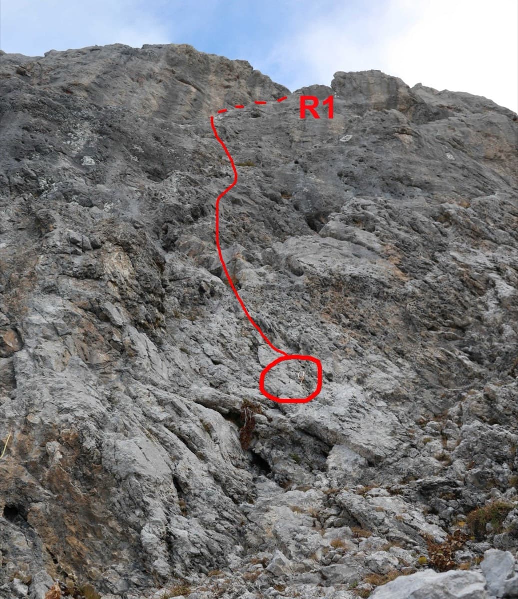
Start of Le sirop pour machin on the Pointe Percée, with the first pitch to belay R1 drawn in red

France · Aravis

Le sirop pour machin

An introduction to mountain multipitch that tops out right under the summit cross of the highest Aravis peak. Grippy fluted limestone is linked by cairned walking sections, and the last pitches are the best.

5b+11 pitches400 m

Sierra de Callosa above Redován

Spain · Vega Baja (Orihuela & Callosa)

Espolón P.D.P.

A long, steady V+ spur to the summit of the Sierra de Callosa on exceptional rock. Many terraces allow a safe retreat, which makes it good mileage for building multipitch experience. Check local seasonal climbing restrictions in the Sierra de Callosa.

5+9 pitches500 m

Read the cautions

No photo yet

Italy · Arco & Valle del Sarca

Orizzonti Dolomitici

A succession of short walls and slabs separated by ledges, with the first two pitches shared with Amazzonia. The crux is a single 5c/6a move just below the P5 belay. It's a relaxed, well-protected outing above the Sarche gorge.

5c10 pitches250 m

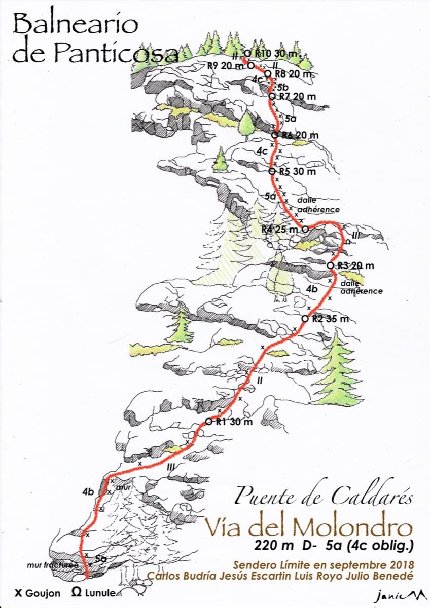
Drawn topo of the Vía del Molondro above the Caldarés bridge, Baños de Panticosa, with bolts and belays marked

Spain · Aragonese Pyrenees (Tena & Canfranc valleys)

Vía del Molondro

Ten short pitches of easy-angled Panticosa granite beside the Caldarés stream, twenty minutes from the car. Mostly friction slabs at 4b to 5a linked by walking-angle ground, with one polished bulge given 5b on the topo. A very gentle first granite multipitch, and a climbing approach to the walls above.

5b10 pitches220 m

Compiled from published sources and last verified October 2026. Bolts, anchors and access change. Climbing is dangerous and you are responsible for your own decisions: check a current topo and read the disclaimer.