Multipitch Atlas

Tanger

Paret del Pessó · Collegats · Spain

Read the cautionsBail with caveatsBolting confidence: medium

A consistent, well-bolted line starting with a crack under the big pylon. Ten pitches of 5b–6a+ are split by a 100 m scramble through a vegetated 'garden' before the final tier.

Paret del Pessó, Collegats: Tanger starts between the shaded corner and the pylonPhoto: NicoBrasFort · CC BY-SA 3.0

Photo

Paret del Pessó, Collegats: Tanger starts between the shaded corner and the pylonPhoto: NicoBrasFort · CC BY-SA 3.0
Hardest pitch
6a+
Pitches
10
Length
300 m
Approach
10 min
Aspect
NE
North-east-facing
Rope
2×45 m
Read before you go

Bolted with no trad gear required by the topos, but high first bolts, old pegs on the hard moves and a runout final pitch on poor rock mean it is not a pure clip-up.

The route

Overview

Tanger climbs the steep conglomerate of the Paret del Pessó in the Collegats gorge, directly above the roadside parking. Seven pitches of sustained wall and crack climbing at 5b to 6a+ lead to a vegetated terrace, a 100 m walk and scramble, then three more pitches up the final tier. The hard moves are closely bolted and can be pulled through at A0, but the first bolt of most pitches is high and the last pitch has a long unprotected section, so it is less of a clip-up than the grade table suggests. Recent parties call the climbing athletic, atmospheric and stiffly graded, with some polish. Allow 4 to 5 hours on the route.

The climbing

Pitch by pitch

Pitches of Tanger
PitchGradeLengthBoltsNotes
P15c35 m10 boltsStraight up the crack, then trend right for the last 10 m. 10 bolts and 1 peg. Bolted belay.
P25c25 m7 boltsThe first bolt is 3 m to the left; do not follow the bolt line 1 m to the right. Then straight up and back left. Belay up on the right. A 2017 party strayed onto newer, shinier bolts on a neighbouring line here and broke a hold.
P36a20 m8 boltsLeft, then straight up; belay on the left. Reported as polished, which makes the crux noticeably harder.
P45b30 m9 boltsLeft, then diagonally right, then straight up. 9 bolts and 1 peg.
P56a+40 m12 boltsSlightly right to a small cave at about 5b; do not follow the gold-coloured hangers straight up. Then the 6a+ section, which goes at A0. 12 bolts and 3 pegs. A 2023 report says two hard moves here rely on an old peg in poor condition.
P65b35 m9 boltsStart right, then straight up to the vegetated ledge. 9 bolts and 1 peg. The finish is on earth, roots and small trees that are worn from use.
P75b40 m7 boltsRight across earth, then traverse back left on slightly friable rock, straight up and round a tree on its left to a belay at the foot of the big garden. 7 bolts and 2 pegs; one peg is driven in too far and needs a thin sling to clip. Variant: the steep wall straight above the P6 belay at 6b, reported in 2024 as well protected on clean rock and a better pitch.
P85b30 m8 boltsReached after the 100 m walk. Start at the very top of the path by earth steps with exposed roots, level with a clump of trees. No bolt is visible from below; the first one is about 7 m up. Then broadly straight up the crack line. 8 bolts and 3 pegs.
P96a+30 m10 boltsStart left (5c), then diagonally right (5b), then a steep step at 6a+ that goes at A0. 10 bolts and 3 pegs. Belay on the left.
P105b30 m5 boltsStraight up. Only 5 bolts and 1 old bolt. The start from the belay is a poorly protected traverse followed by a steep, earthy corner before the first good bolt, and there is a long unprotected stretch on poor rock and earth. Belay at 30 m, then continue about 15 m of easy ground (3b) to a tree belay at the descent path.

Getting there

Approach

To the parking

From La Pobla de Segur take the N-260 north-east towards Sort into the Collegats gorge. About 8 km from La Pobla, roughly 100 m after the exit of the first tunnel, there is a small pull-in on the left for 3 or 4 cars (sign for the Cova de la Serpent path). If it is full, park just before on the old road that bypasses the first tunnel on the outside. The camptocamp access page mentions the La Pobla railway (fgc.cat) for public transport to La Pobla de Segur; from there you still need to cover the 8 km to the gorge.

On foot · about 10 min

10 minutes. From the parking you can see the crack of the first pitches directly above the big electricity pylon. Take the signed Cova de la Serpent path, then leave it for a small track that passes near the pylon to the foot of the wall and follow the base rightwards. Find the Agulla del Gos, a pinnacle leaning against the wall that forms a big corner on its right. Tanger starts about 30 m right of that corner at a crack and is the second bolted line after the corner. The ground at the base is awkward (big earth steps).

Finding the route · 1 photo

  • Start of the routeLooking up from the start of Tanger (September 2023): the conglomerate slab with the steeper wall forming a corner on its left, bushes at the base.Photo: Anthony Marty · CC BY-NC-ND 3.0

Approach photo

Map of the walk-in

  • Crag
  • Parking

Loading map

The point marks the crag, not the exact start of the route.

Coordinates · crag

42.28514, 1.03395

Parking

42.28611, 1.03667

Parking du Défilé des Collegats (camptocamp access point)

Point from camptocamp waypoint 696691

For your phone or watch

Download GPX

Contains the route point and parking. Opens in most mapping apps and GPS watches.

Points are compiled from published sources, with the precision stated above. They were not surveyed on the ground: check them against a current topo.

Getting down

Descent

On foot, 30 minutes to 1 hour depending on the source. From the top follow a cairned path south along the clifftop (faint red paint marks), then down a rounded spur to a 150 m line of chains, cables and fixed ropes with some rungs, which leads down to two big pylons. Follow the Cova de la Serpent path north back to the parking. It feels like a via ferrata descent; one rung section is a long reach for people under about 1.70 m. Every belay is equipped for abseiling, but abseiling the route is not recommended because of the vegetation.

Retreat

Bailing off the route

Bail with caveats

Yes, but it is discouraged. Camptocamp states that every belay is equipped for abseiling and then advises against abseiling the route because of the vegetation; an older French topo says it is possible but slower than walking off. Expect ropes to catch on trees and earthy ledges, especially around the garden between the two tiers.

Retreat from
Any belay. The cleanest retreat is from the first five pitches, which are steep wall and crack. Above pitch 6 you are on vegetated ledges and then the 100 m garden; no walk-off from the garden is described.
Point of no return
None is stated. By inference, once you are on the final tier (pitches 8 to 10) the top is closer than the ground and the walk-off starts there.
Carry
2×45 m (pitches are up to 40 m), as the route requires anyway. Gloves if you end up on the chain descent.
Basis
Part stated, part inferredCamptocamp states that all belays are equipped for abseil and that abseiling is not advised because of vegetation; where retreat is cleanest and the turning point are inferred from the pitch descriptions.

Partly inferred from the route facts

Safety

Hazards

  • The first bolt of most pitches is high and several pitch starts could end in a ground or ledge fall (camptocamp remarks and 2023 report).
  • Last pitch (P10): only 5 bolts in 30 m, with a poorly protected start and a long runout on poor rock and earth. Reported in 2022, 2023 and 2024.
  • Old pegs are part of the protection on several pitches; two hard moves on the first 6a+ pitch are protected by a peg in poor condition (2023).
  • P8 after the garden: no bolt visible from the ground, first bolt about 7 m up.
  • Newer bolted lines run close on both sides. Follow the older, duller hangers and check the topo, especially on P2 and P5.
  • The 100 m link between tiers is steep earth with rock steps; the topo advises good shoes and a rope.
  • Friable rock on P7 and worn roots and saplings at the end of P6. Polished holds on the harder sections.
  • The descent chains are hard on the hands without gloves.

Sun and weather

Conditions

North-east facing conglomerate at about 600 m. In May the wall comes into the sun early and stays in it until about 14:00, so climb in the afternoon shade in warm weather. In late autumn and winter the route gets no sun and is cold. Trip reports are from April, May, September and November. Wind can pick up above the middle terrace in the afternoon.

Usual season · Apr to Jun, Sep to Oct

Sun on the wall · NE-facing

Working out the sunlit hours for this month.

  • January: not yet worked out
  • February: not yet worked out
  • March: not yet worked out
  • April (usual season): not yet worked out
  • May (usual season): not yet worked out
  • June (usual season): not yet worked out
  • July: not yet worked out
  • August: not yet worked out
  • September (usual season): not yet worked out
  • October (usual season): not yet worked out
  • November: not yet worked out
  • December: not yet worked out

Sun on the wallDaylight, wall in shade● Usual season

Estimated from the wall's aspect only. Ignores surrounding terrain, gullies and the wall's exact shape. Clock times are local to the wall (Central European time), for the 15th of each month.

Climate figures for Collegats are not available yet

What to carry

Gear

2 x 45 m ropes (camptocamp); 13 to 15 quickdraws including some extendable ones; a thin sling for the buried peg on P7; thick grippy gloves for the chain descent. Cams and nuts are not needed according to the topos, but a 2024 party suggested two medium cams (Camalot red and green) to reduce the exposure on the last pitch. Trainers are worth carrying for the walk between the two tiers.

Checklist

Quickdraws
15
Rope
2×45 m
Helmet
One each
Abseil device and prusik
The descent or the retreat involves abseiling

Derived from the route data; check it against a current topo

From climbers

Reader reports

Reader reports are not being collected yet. Until they are, check a current topo and the local club or guidebook publisher for recent changes to Tanger.

Worth knowing

Tips

  • On P7 the belayer can leave the stance and move right along the easy ledge to cut rope drag.
  • Take the 6b variant above the P6 belay if you are comfortable at the grade; several parties found the original P7 the worst pitch.
  • Carry on 15 m past the last belay to a tree at the descent path rather than stopping at the 30 m anchor.
  • Accommodation mentioned by the French topo: a hostel at Cellers (about 30 minutes' drive, sells local topos) and a campsite at the entrance to the gorge near La Pobla de Segur.

Open questions

Where sources disagree

  • Length: camptocamp gives 300 m of climbing height (650 m total field); the Topos Espagne blog says 450 m including the walk. The 300 m listed here follows camptocamp.
  • Pitch lengths: the 2008 blog gives P1 50 m and P9/P10 35 m; the camptocamp French text gives 35 m and 30 m. The camptocamp figures are used here as the more detailed source.
  • Descent time: 30 minutes on camptocamp (25 minutes in a 2023 report), 1 hour on the blog.
  • Abseil descent: the blog says abseiling is possible but slower; camptocamp advises against it because of vegetation.
  • Quickdraws: 15 (camptocamp French), 13 (camptocamp Spanish), 14 (blog).
  • Cams: both topos say none are needed, but a 2024 trip report recommends two medium cams for the last pitch.
  • Grades: the Spanish camptocamp text and the blog grade the easier pitches IV+ to V rather than 5b/5c; a 2022 party found the grades severe.

Provenance

Sources

Around 6a+ · about 10 pitches

Similar elsewhere

No photo yet

Spain · Vega Baja (Orihuela & Callosa)

Botri

The classic of Redován: ten pitches and 300 m of steady grade 5 with three steeper pitches on red rock. The eighth pitch, a traverse right into an overhanging corner above the orange cliffs, is the one people remember. Closed from January to June for nesting eagles.

6a+10 pitches300 m
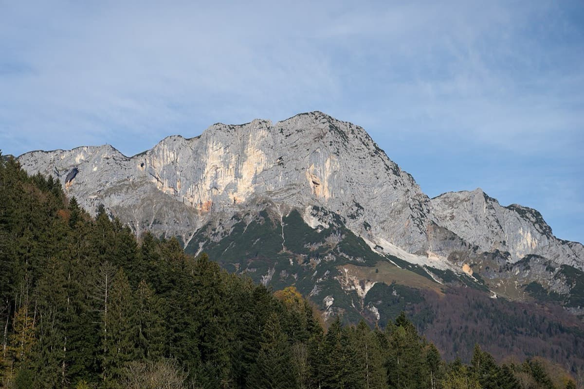
South face of the Berchtesgadener Hochthron (Untersberg), seen from Maria Gern

Germany · Berchtesgaden & Bad Reichenhall

Dahoam is Dahoam

A long-day alpine-flavoured plaisir route on the Untersberg's summit wall. Pitches range from UIAA 5+ to 6+ (≈5b–6b), with 5+ obligatory.

6a+10 pitches250 m

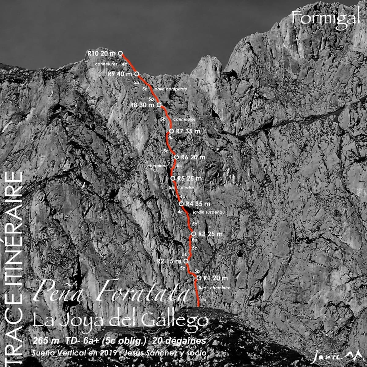
Topo of La Joya del Gállego on the Peña Foratata

Spain · Aragonese Pyrenees (Tena & Canfranc valleys)

La Joya del Gállego

Varied, sustained limestone of chimneys, dihedrals and compact fluted slabs high above the Tena valley. Bearded-vulture nesting closes the face from 1 Dec to 31 Jul unless lifted early, so check montanaregulada.org.

6a+10 pitches265 m

Read the cautions

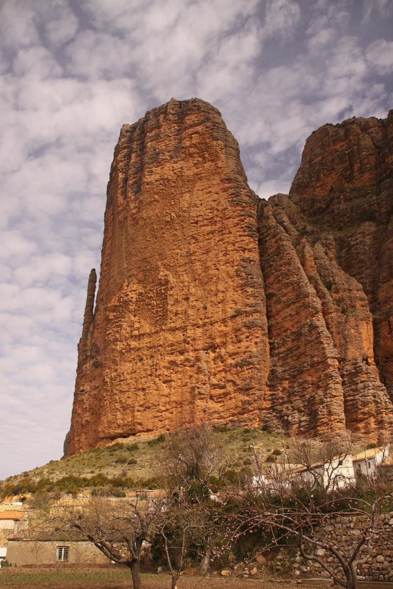
Mallo Pisón above the village of Riglos, with El Puro on its left

Spain · Riglos & Agüero (Mallos)

Ursi

A way up the Pisón at 6a+ if you accept two pitches of pulling on bolts at the start. The seventh pitch is a contender for the best corner at Riglos. Take care with the rock on pitches 3 and 4.

6a+10 pitches270 m

Read the cautions

Compiled from published sources and last verified October 2026. Bolts, anchors and access change. Climbing is dangerous and you are responsible for your own decisions: check a current topo and read the disclaimer.