Multipitch Atlas

Plattenweg

Sustenpass – South Slabs (Steingletscher) · Susten · Switzerland

Easy to bailBolting confidence: high

Relaxed, low-angle granite slab climbing on small edges, 15 minutes from the Sustenpass road. It makes an ideal first alpine-granite multipitch.

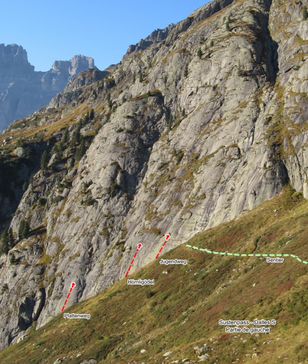
Sustenpass south slabs, left part, with the start of Plattenweg markedPhoto: Fabien Pierre · CC BY-SA 3.0

Topo

Sustenpass south slabs, left part, with the start of Plattenweg markedPhoto: Fabien Pierre · CC BY-SA 3.0
Hardest pitch
5b+
Pitches
7
Length
200 m
Approach
20 min
Aspect
S
South-facing
Rope
2×50 m

The route

Overview

Plattenweg is a seven-pitch, roughly 200 m slab route on the south-facing Platten above the Susten pass road near Steingletscher, one of the leftmost (western) lines on the slabs. The climbing is low-angle and never sustained, on small edges with the odd flake and crack, at 4b to 5b+. It is 15-20 minutes from the car in alpine surroundings and is abseiled in about half an hour to an hour. It suits a first multipitch on this kind of rock, though the bolts on the easy ground are further apart than at a sport crag.

The climbing

Pitch by pitch

Pitches of Plattenweg
PitchGradeNotes
P14c+Start at the foot of the big block forming a crack-corner. One 2024 party felt pitches 1 and 2 were nearer grade 5 than 4. R1 is the only belay without a chain.
P24c+Slab. Can be linked with pitch 1 on 50 m ropes.
P34cSlab trending up and left.
P44bShort steep step at the start, then easy.
P55a+Slab.
P65b+Slab; the crux is the thin moves off the belay. Reported as a fine pitch and overall no harder than the first pitches.
P75a+Slab and a crack.

Getting there

Approach

To the parking

Park in a hairpin on the Susten pass road about 3 km west of the pass, at the point marked 1946 m, just above Steingletscher (Berghotel Steingletscher, dormitories). Approach from Innertkirchen and Gadmen on the Bernese side or from Wassen over the pass. The pass is closed in winter; the road is usually open as far as Steingletscher from mid-April. A postbus serves Steingletscher in season.

On foot · about 20 min

15-20 min on a well-marked track from the 1946 m parking, with chains on a few short sections. A 2024 party found the ground a bit slippery. The route name is painted at the base; the first pitch starts at the foot of a big block that forms a crack-corner.

Finding the route · 2 photos

Approach photo

Map of the walk-in

  • Crag

Loading map

The point marks the crag, not the exact start of the route.

Coordinates · crag

46.73555, 8.41077

Point from camptocamp waypoint 187365

For your phone or watch

Download GPX

Contains the route point. Opens in most mapping apps and GPS watches.

Points are compiled from published sources, with the precision stated above. They were not surveyed on the ground: check them against a current topo.

Getting down

Descent

Abseil the route. Camptocamp allows 30 min; a 2024 party made five abseils with 2×50 m ropes and took an hour. Then walk back down the approach track.

Retreat

Bailing off the route

Easy to bail

Yes. The route is abseiled as its normal descent, in about five abseils with 2×50 m ropes, and every belay except R1 has a chain. It is a low-angle slab, so the abseils are simple.

Retreat from
Any belay from R2 upwards. R1 is the only belay without a chain; since pitches 1 and 2 can be climbed as one on 50 m ropes, an abseil from R2 should reach the ground without stopping at R1 (inference).
Carry
2×50 m ropes. A maillon or old karabiner if you have to abseil from R1.
Basis
Part stated, part inferredCamptocamp states the abseil descent and a 2024 report states five abseils on 2×50 m and that only R1 lacks a chain; skipping R1 on the way down is inferred from the fact that pitches 1 and 2 link on a 50 m rope.

Partly inferred from the route facts

Safety

Hazards

  • Bolt spacing: rated P1 on camptocamp and called very well equipped in a 2016 report, but a 2024 party found some bolts 'a bit far' on the slabs, and the Plaisir guide is quoted as rating the protection 'gut+' rather than 'super'.
  • R1 has no chain; all other belays are chained (2024 report).
  • Friction slab at 2000 m: not a route for damp rock, and the approach track is slippery when wet.
  • Linking pitches 3 and 4 needs 60 m ropes and creates rope drag; with 50 m ropes a 2024 party had to move together briefly.

Sun and weather

Conditions

South facing at 1900-2100 m. The season follows the pass road, roughly June to early October; trip reports run from mid-June to the end of October. Camptocamp gives about 2 h for the climb.

Usual season · Jun to Sep

Sun on the wall · S-facing

Working out the sunlit hours for this month.

  • January: not yet worked out
  • February: not yet worked out
  • March: not yet worked out
  • April: not yet worked out
  • May: not yet worked out
  • June (usual season): not yet worked out
  • July (usual season): not yet worked out
  • August (usual season): not yet worked out
  • September (usual season): not yet worked out
  • October: not yet worked out
  • November: not yet worked out
  • December: not yet worked out

Sun on the wallDaylight, wall in shade● Usual season

Estimated from the wall's aspect only. Ignores surrounding terrain, gullies and the wall's exact shape. Clock times are local to the wall (Central European time), for the 15th of each month.

Monthly climate averages for Susten, 1991-2020
MeasureJanFebMarAprMayJun (usual season)Jul (usual season)Aug (usual season)Sep (usual season)OctNovDec
Mean daily high °C−4−31381215151171−3
Mean daily low °C−10−10−7−404774−0−6−9
Rain days 1 mm or more141315151821222016141515
Sunshine hours a day6.17.18.610.110.511.111.510.49.07.76.05.4

● marks the usual climbing season. Averages for 1991-2020 at about 2008 m. Area climate from Open-Meteo reanalysis (about 10 km grid): the wall and valley can differ. Data: Open-Meteo, CC BY 4.0.

What to carry

Gear

2×50 m ropes and 10 quickdraws. Helmet. Trip reports say cams and slings are not needed.

Checklist

Quickdraws
10
Rope
2×50 m
Helmet
One each
Abseil device and prusik
The descent or the retreat involves abseiling
Maillons or spare karabiners
To leave behind if you retreat

Derived from the route data; check it against a current topo

From climbers

Reader reports

Reader reports are not being collected yet. Until they are, check a current topo and the local club or guidebook publisher for recent changes to Plattenweg.

Worth knowing

Tips

  • Link pitches 1 and 2 with 50 m ropes to save time.
  • Around 2 h 30 min for the climb and abseils is a typical time for a competent pair.
  • The slabs hold routes of one to eight pitches, so it is easy to add a second line the same day.
  • The Alpkäserei below Steingletscher sells ice cream; Berghotel Steingletscher and Chalet Ochsen offer beds.

Open questions

Where sources disagree

  • Rock: the camptocamp route page says granite, while the camptocamp crag page and a 2024 trip report call it gneiss.
  • Protection: 'super' according to a 2016 trip report, 'gut+' in the Plaisir guide as quoted in that report, and 'sometimes a bit far' in a 2024 report.
  • Descent time: 30 min (camptocamp description) versus 1 h for five abseils (2024 report).
  • No independent route description was found outside camptocamp; the Filidor page only confirms the area and guidebook.

Provenance

Sources

Same area

More in Susten

All routes in Susten
Left side of the Sustenpass south slabs with the starts of Plattenweg, Hörnligödel and Jugendweg marked

Switzerland · Susten

Jugendweg

Seven easy, unsustained pitches of edged slab on the left side of the Steingletscher slabs, never harder than 4b. The line is obvious and the glacier scenery is the main event. A good first multipitch, and easy to pair with a neighbouring route the same day.

4b7 pitches200 m
Around 5b+ · about 7 pitches

Similar elsewhere

The Amptrax sector of Frontales, El Chorro

Spain · El Chorro

Lluvia de Asteroides

An airy, exposed adventure on clean, solid rock: the best long easy route on the Frontales and an ideal first big multipitch.

5+8 pitches251 m

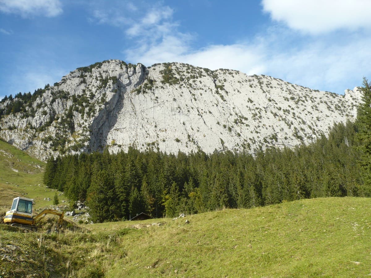
The south face of the Brüggler above the Schwändital

Switzerland · Glarus (Brüggler)

Highway

Seven homogeneous pitches of grade 5 up the middle of the Brüggler's big limestone slab, much of it on water runnels, finishing among the pines near the summit cross. Never hard, but it climbs all the way and the bolts are not close. Best if you are solid at 5c.

5b7 pitches200 m

Read the cautions

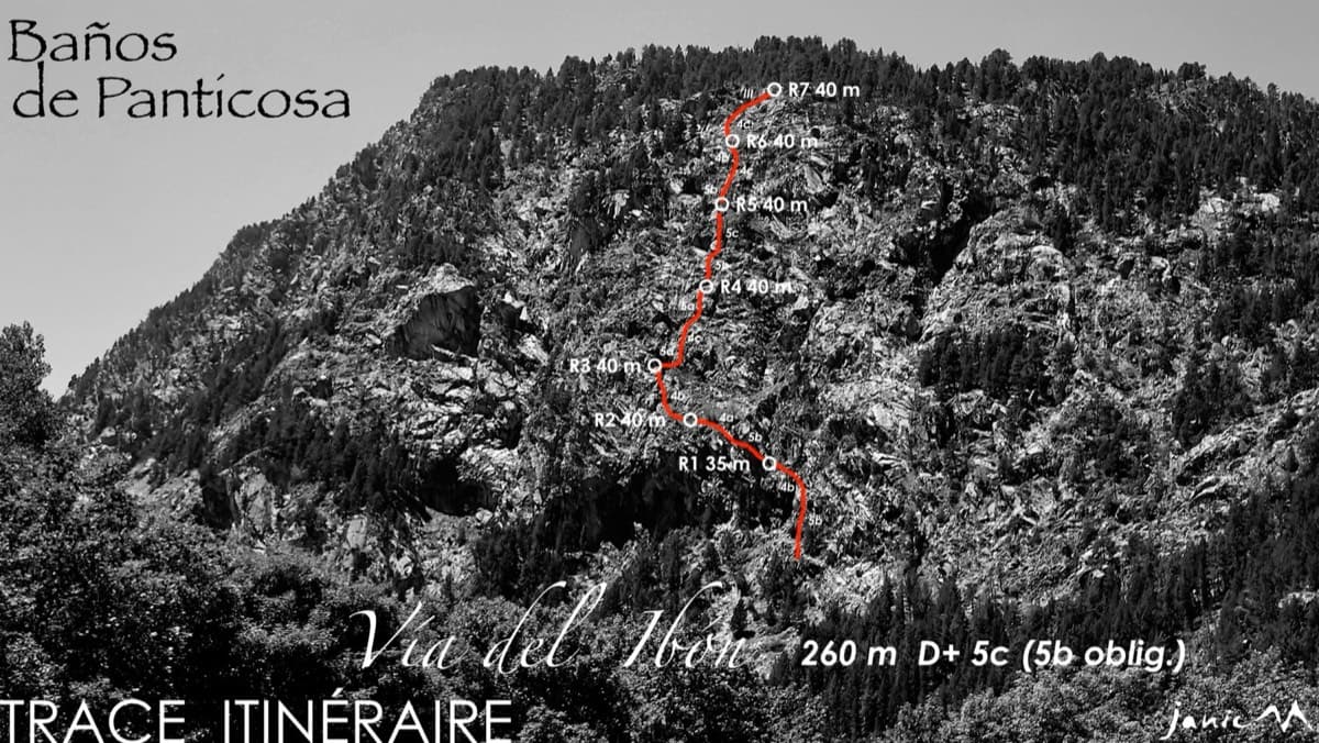
The Pared del Ibón above Baños de Panticosa with the line and belays of Vía del Ibón

Spain · Aragonese Pyrenees (Tena & Canfranc valleys)

Vía del Ibón

A mountain-style line on dark, weathered granite twenty-five minutes above the spa of Baños de Panticosa. It links ramps, a short overhanging break, slabs and a rounded boulder, with one well-bolted 5c move and the rest 4b to 5b. The rock between the good sections is earthy and lichenous, but the friction is excellent and the bolting generous.

5c7 pitches260 m

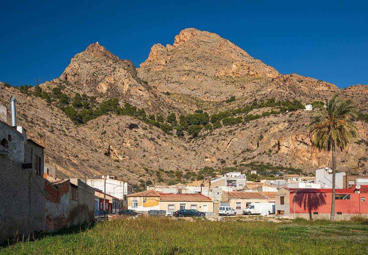
Sierra de Callosa above Redován

Spain · Vega Baja (Orihuela & Callosa)

Espolón P.D.P.

A long, steady V+ spur to the summit of the Sierra de Callosa on exceptional rock. Many terraces allow a safe retreat, which makes it good mileage for building multipitch experience. Check local seasonal climbing restrictions in the Sierra de Callosa.

5+9 pitches500 m

Read the cautions

Compiled from published sources and last verified October 2026. Bolts, anchors and access change. Climbing is dangerous and you are responsible for your own decisions: check a current topo and read the disclaimer.