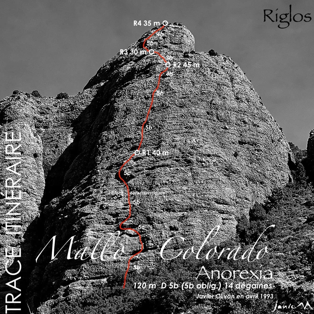
Spain · Riglos & Agüero (Mallos)
Anorexia
The best-known route on the Mallo Colorado. Two steep, juggy panza pitches have a well-protected boulder move, giving a short taste of real Riglos steepness at a friendly grade.
5c4 pitches150 m
Velika stena (Big Wall), right side · Osp · Slovenia
Read the cautionsBail with caveatsBolting confidence: high
The easiest line on Osp's famous overhanging Big Wall, following an obvious right-slanting ramp, the only non-overhanging part of the face. It is in shade until about 11:30 in July.
Fully bolted and open, but pitch 1 is run-out and a little loose, and the wall immediately to the right is closed, so check current restrictions locally.
The route
The easiest line on Osp's Big Wall (Velika stena), a 110 m face better known for its huge overhangs and 7th and 8th grade multipitches. Medo takes the only non-overhanging part: an easy pedestal to a big terrace, a rightward traverse along a ledge and ramp, then a corner, a flake and a final crack to the plateau. It is fully bolted with 10 mm bolts plus a few of the original pegs. The grades are honest and the setting is leafy but the climbing itself is clean. It is a classic 1979 line that was later retro-bolted, and it is the right-most route on the wall that is open to climbing.
The climbing
| Pitch | Grade | Length | Notes |
|---|---|---|---|
| P1 | 4 | 35 m | Climb the very short corner (one bolt), exit left, go straight up for about 25 m and move right onto the terrace behind a big flake. Belay on a large glued chain with rings on a spacious terrace. Planetmountain grades it II to IV and calls it a little loose with little protection, over only 20 m; the Spanish camptocamp text gives grade 3 and 30 m. One or two cams can be placed. |
| P2 | 5b | 30 m | From the right end of the terrace make a delicate first move, then traverse rightwards along a fine ledge for about 15 m, crossing the bolt lines of modern routes that go straight up. Do not follow those. Where the ledge ends, go up and right into a corner and on to a comfortable two-bolt belay just after the second tree. Planetmountain grades it V+ and V (about 5a to 5b) and noted one bolt without a hanger near the end of the ledge. |
| P3 | 5c | 30 m | A few metres right, then an awkward slab and corner slanting left (bolts and pegs), a short reachy corner, and a big flake or small pillar with a long move. Exit by an exposed traverse left to a tree. Comfortable two-bolt belay. Planetmountain grades it V+ and VI- and suggests a Camalot 3 for the long move if you are at your limit. |
| P4 | 5c | 30 m | Slightly left up a cracked slab to a short steep corner, then straight up on easier ground. The final crack is the 5c crux and leads to a ledge a few metres below the plateau, with a two-bolt belay or chain. Planetmountain grades the sections V, VI, IV and V+. An easy scramble leads onto the plateau. |
Getting there
Osp is a small village in south-west Slovenia, a few kilometres from Trieste and Koper, close to the Črni Kal exit of the A1 motorway from Ljubljana. Park at the climbers' car park next to Camp Vovk in the southern part of the village (small fee), or at the car park below Mišja peč about 500 m before the village. Do not park in the village itself. Camptocamp lists no public transport service.
15 to 20 minutes. From the bridge just after the south-east entrance to the village, before crossing the stream, take the made path on the left bank towards the big wall; do not fork right. Pass the cave (Pajkova streha) and continue rightwards up a steep path along the foot of the wall. The path becomes much fainter near the start. The route begins at the foot of a rocky pedestal among trees, shared with several routes: a short, slightly hidden corner with a sign about peregrine falcon protection. The name shown at the start is 'Internacionala', not Medo.
Loading map
The point marks the crag, not the exact start of the route.
Parking
Osp (camping) (camptocamp access point)
Point from camptocamp waypoint 805693
Contains the route point and parking. Opens in most mapping apps and GPS watches.
Points are compiled from published sources, with the precision stated above. They were not surveyed on the ground: check them against a current topo.
Coordinates: 45.57133, 13.86274 (crag) · Parking: 45.57054, 13.85649
Getting down
On foot: on the plateau walk straight ahead (north), then left to join the marked path, and follow it leftwards down past the Babna sector to the village. 30 to 40 minutes. By abseil, as described by Planetmountain: from the top make a 10 m abseil to the ledge a few metres from the last belay (to the right looking down). From there, with two ropes, use the line equipped with a large ring: 25 m (intermediate stance possible), then 50 m (intermediate stance possible, with a big pendulum) to the terrace at the top of pitch 1, then 30 m to the ground. With a single rope, use instead the abseil stations of the sport route Špargelj direkt, about 5 m left of the big ring. Camptocamp mentions 3×30 m but marks it as unverified.
Retreat
Bail with caveats
You can retreat easily from the top of pitch 1, where a large glued chain with rings sits on a terrace 30 m above the ground. Higher up it is less clear. Pitch 2 traverses about 15 m right along a ledge, the belays above are two bolts, and the equipped abseil line is a separate line that needs two ropes and includes a 50 m abseil with a big pendulum.
Partly inferred from the route facts
Safety
Sun and weather
South-west to west facing at only 50 to 230 m altitude. The route stays in full shade until at least 11:30 in mid-July, so it is climbable on a hot summer morning; a party did it from 9 to 11 am in very hot weather. Camptocamp lists September to June as the season for the wall. Allow about 2 hours of climbing.
Sun on the wall · SW-facing
Working out the sunlit hours for this month.
Sun on the wallDaylight, wall in shade● Usual season
Estimated from the wall's aspect only. Ignores surrounding terrain, gullies and the wall's exact shape. Clock times are local to the wall (Central European time), for the 15th of each month.
| Measure | Jan (usual season) | Feb (usual season) | Mar (usual season) | Apr (usual season) | May | Jun | Jul | Aug | Sep | Oct (usual season) | Nov (usual season) | Dec (usual season) |
|---|---|---|---|---|---|---|---|---|---|---|---|---|
| Mean daily high °C | 7 | 8 | 12 | 16 | 20 | 24 | 27 | 27 | 22 | 17 | 12 | 8 |
| Mean daily low °C | 1 | 1 | 4 | 8 | 12 | 16 | 18 | 18 | 14 | 10 | 6 | 2 |
| Rain days 1 mm or more | 9 | 9 | 10 | 11 | 12 | 10 | 8 | 9 | 11 | 12 | 13 | 10 |
| Sunshine hours a day | 6.0 | 7.5 | 9.1 | 10.6 | 11.9 | 12.9 | 13.3 | 12.3 | 10.2 | 8.0 | 6.0 | 5.4 |
● marks the usual climbing season. Averages for 1991-2020 at about 224 m. Area climate from Open-Meteo reanalysis (about 10 km grid): the wall and valley can differ. Data: Open-Meteo, CC BY 4.0.
What to carry
12 quickdraws and a few slings. One 70 m rope, or better two 50 m ropes if you plan to abseil. Optional: one or two small to medium cams for pitch 1 and a Camalot 3 for the long move on pitch 3. Helmet.
Derived from the route data; check it against a current topo
From climbers
Reader reports are not being collected yet. Until they are, check a current topo and the local club or guidebook publisher for recent changes to Medo.
Worth knowing
Open questions
Provenance
Around 5c · about 4 pitches
Spain · Riglos & Agüero (Mallos)
The best-known route on the Mallo Colorado. Two steep, juggy panza pitches have a well-protected boulder move, giving a short taste of real Riglos steepness at a friendly grade.
5c4 pitches150 m
Morocco · Tafraout (Anti-Atlas)
Bolted granite slabs to the top of a dome above the Tafraout valley, with a hand-traverse across a gully on pitch 3. Short, but a rest day from trad in an area that is otherwise almost all cams.
5c4 pitches95 m
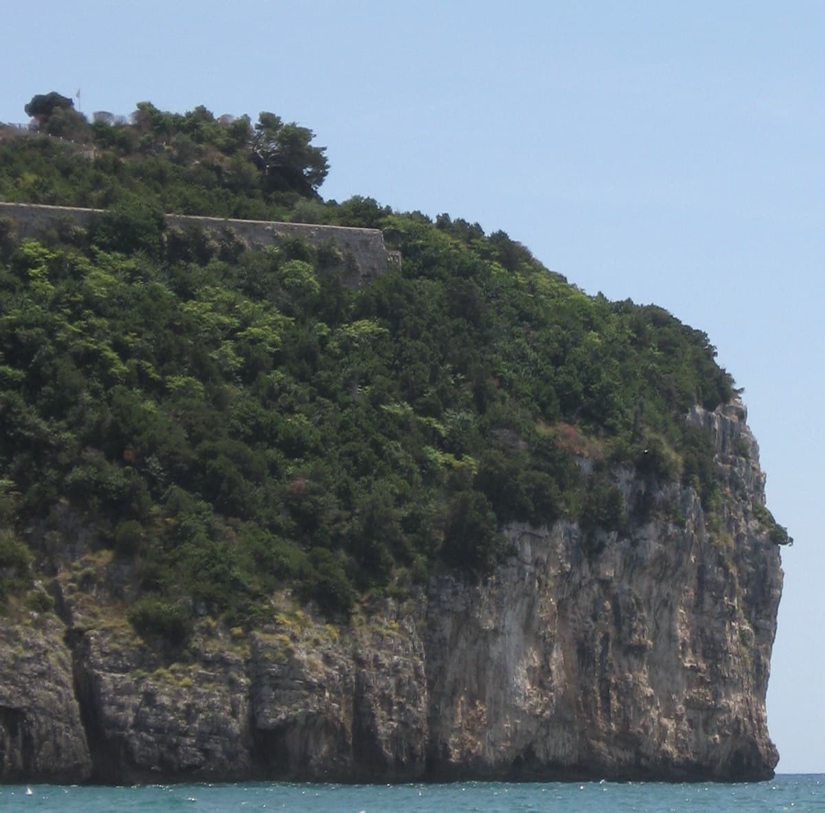
Italy · Gaeta & Sperlonga
This was the second route on Montagna Spaccata and is the cliff's classic moderate. It's never hard but never trivial, with continuous exposure above the sea: a horizontal crack traverse, an athletic juggy chimney and corners. Gulliver gives UIAA grades V–V+ / IV+–V / V+ / V / V–IV+ (5c max), converted here.
5c5 pitches125 m
Read the cautionsCommitting
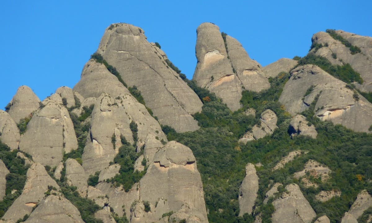
Spain · Montserrat
A straightforward line up the 'Phrygian cap' visible from the monastery. Only the short vertical step on pitch 3 is sustained. It is a good route for learning Montserrat pebble technique and has a summit cross with a big view. The approach takes about 10 min from the Sant Joan funicular top.
5c5 pitches140 m
Compiled from published sources and last verified October 2026. Bolts, anchors and access change. Climbing is dangerous and you are responsible for your own decisions: check a current topo and read the disclaimer.