Multipitch Atlas

La Vía Más Fácil de Agüero

Mallos de Agüero, east face · Riglos & Agüero (Mallos) · Spain

Easy to bailBolting confidence: high

The name is accurate: four even pitches of 4a to 4b up a gently angled conglomerate spur, with a bolt every few metres. Made for a first multipitch or a first lead, and it finishes on top of the Agüero massif. Combine it with Tierra de Naide or Tierra de Todos on the same face.

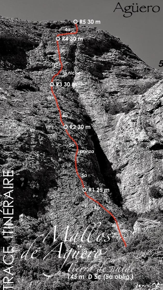
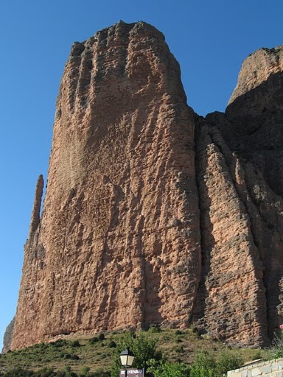
Line of La Vía Más Fácil de Agüero on the east face of the Mallos de Agüero, with belays and the descent gully markedPhoto: janic · CC BY-SA 3.0

Topo

Line of La Vía Más Fácil de Agüero on the east face of the Mallos de Agüero, with belays and the descent gully markedPhoto: janic · CC BY-SA 3.0
Hardest pitch
4b
Pitches
4
Length
120 m
Approach
20 min
Aspect
E
East-facing
Rope
2×60 m

The route

Overview

One of three routes the Sendero Límite team prepared on the slabby east face of the Mallos de Agüero, intended for summer afternoons when the face is in shade. Four pitches of 30 m, each about 4b, climb a spur of moderate angle on rounded cobbles. The grade is very even and the bolting close, so it works well for beginners and for learning rope work. School and club groups use it for exactly that.

The climbing

Pitch by pitch

Pitches of La Vía Más Fácil de Agüero
PitchGradeLengthBoltsNotes
P14b30 m9 boltsAn easy-angled slab to a niche, which you leave on the right by a short wall, then straight up. Given 4a/4b.
P24b30 m11 boltsDiagonally right, then straight up, then right again to the belay. Eleven bolts and one thread. The best pitch; one party measured 35 m.
P34b30 m7 boltsA rising traverse left on good holds, then direct. In 2023 a flake under one bolt at the leftward turn was about to come off: go a metre further along the ledge before climbing the short wall.
P44b30 m5 boltsUp above the belay to a niche, out of it on the right and straight to the top. Given 4b/4a.

Getting there

Approach

To the parking

Agüero is west of Riglos. Coming from Huesca on the A-132, turn left onto the HU-534 about 1 km before Murillo de Gállego. As you reach Agüero take the road on the right to the east car park at the entrance to the village (about 725 m).

On foot · about 20 min

About 20 min. From the car park take the path beside the information board (Vuelta a los Mallos de Agüero). It climbs north-east on the true right of the stream bed, passes a boulder with two bolted single pitches, crosses to the other bank at about 760 m and turns north. At about 800 m, where the east face with its deep crack between two spurs is in full view, leave the main path at a cairn and take the small path left towards the descent gully. The start is at the foot of the face, marked with a ribbon.

Finding the route · 3 photos

  • Walk-inThe marked path from the Agüero car park (Vuelta a los Mallos, towards the Collada Pedro) with the east face coming into view on the left.Photo: janic · CC BY-NC-ND 3.0
  • Walk-inLeaving the main path and climbing through the scrub towards the foot of the east face of the Mallos de Agüero.Photo: janic · CC BY-NC-ND 3.0
  • Start of the routeThe start of the route: a tape with 'La Vía Más Fácil de Agüero' written on it hangs at the foot of the face (photographed in 2020).Photo: janic · CC BY-NC-ND 3.0

Approach photo

Map of the walk-in

  • Crag
  • GPS line

Loading map

The point marks the crag, not the exact start of the route.

GPS line: a line of the walk-in and the descent drawn by its source, not a recorded track. Line drawn on the Camptocamp route page: loop from the Agüero car park to the east face and back. Do not follow it blindly.

GPS line: Camptocamp contributors · CC BY-SA 3.0

Coordinates · crag

42.35920, -0.79598

Point from camptocamp waypoint 1160100

For your phone or watch

Download GPX

Contains the route point and a GPS line. Opens in most mapping apps and GPS watches.

Points are compiled from published sources, with the precision stated above. They were not surveyed on the ground: check them against a current topo.

Getting down

Descent

From the top go to the gully at the north end of the east face. A 2023 party made one long abseil of 30 m there and then followed the path; the opening team describes the same gully as a descent with a delicate down-climb. The belays on the route are also equipped for abseiling.

Retreat

Bailing off the route

Easy to bail

Every belay is equipped for abseiling and the pitches are 30 m, so you can go down from anywhere with two ropes. The traverses on pitches 2 and 3 mean the abseil line is not perfectly straight.

Retreat from
Any belay.
Point of no return
None.
Carry
Two ropes (pitches are 30 m, so a single 60 m should also reach, but this is not stated).
Basis
Part stated, part inferredCamptocamp states the belays are equipped for abseils; nobody reports actually retreating, and the single-rope option is inferred from pitch lengths.

Partly inferred from the route facts

Safety

Hazards

  • A loose flake under a bolt on pitch 3 (reported April 2023).
  • Hollow-sounding cobbles in places, as on all Agüero conglomerate.
  • The descent gully needs an abseil or a careful down-climb.

Sun and weather

Conditions

East-facing at 800 to 940 m: morning sun, shade in the afternoon. The openers recommend summer afternoons. Reports are from April, late September and late October; the conglomerate dries quickly after light rain.

Usual season · Mar to Jun, Sep to Nov

Sun on the wall · E-facing

Working out the sunlit hours for this month.

  • January: not yet worked out
  • February: not yet worked out
  • March (usual season): not yet worked out
  • April (usual season): not yet worked out
  • May (usual season): not yet worked out
  • June (usual season): not yet worked out
  • July: not yet worked out
  • August: not yet worked out
  • September (usual season): not yet worked out
  • October (usual season): not yet worked out
  • November (usual season): not yet worked out
  • December: not yet worked out

Sun on the wallDaylight, wall in shade● Usual season

Estimated from the wall's aspect only. Ignores surrounding terrain, gullies and the wall's exact shape. Clock times are local to the wall (Central European time), for the 15th of each month.

Climate figures for Riglos & Agüero (Mallos) are not available yet

What to carry

Gear

Camptocamp lists 2×60 m ropes and 16 quickdraws, which is what you need to link the pitches in pairs (expect heavy rope drag). Climbed pitch by pitch, 11 quickdraws cover the longest pitch. Helmet.

Checklist

Quickdraws
16
Rope
2×60 m
Helmet
One each
Abseil device and prusik
The descent or the retreat involves abseiling

Derived from the route data; check it against a current topo

From climbers

Reader reports

Reader reports are not being collected yet. Until they are, check a current topo and the local club or guidebook publisher for recent changes to La Vía Más Fácil de Agüero.

Worth knowing

Tips

  • Allow 1.5 hours for the route and about 3 hours car to car.
  • Parties routinely climb two of the three east-face routes in a day.
  • If you link pitches, extend the bolts on the diagonals.

Open questions

Where sources disagree

  • Approach start: camptocamp starts from the east car park at the village entrance; the openers' blog starts from the upper part of the village near the old people's home.
  • Pitch 2 length: 30 m on the topo, 35 m according to two reports.
  • Descent: 'a delicate down-climb' (openers) against 'one 30 m abseil' (2023 party).

Provenance

Sources

Same area

More in Riglos & Agüero (Mallos)

All routes in Riglos & Agüero (Mallos)
The Adamelo spur on Mallo Pisón, Riglos

Spain · Riglos & Agüero (Mallos)

Espolón del Adamelo

This is the gentlest way to sample Riglos. Polished pockets and two bulging 'panzas' lead to a 6a crux that can be pulled through on the bolts (A0). The upper spur is easy, and the Pisón towers loom close by.

6a7 pitches175 m

Read the cautions
Topo of Sendero Límite on the south face of Peña Rueba (Mallo Común)

Spain · Riglos & Agüero (Mallos)

Sendero Límite

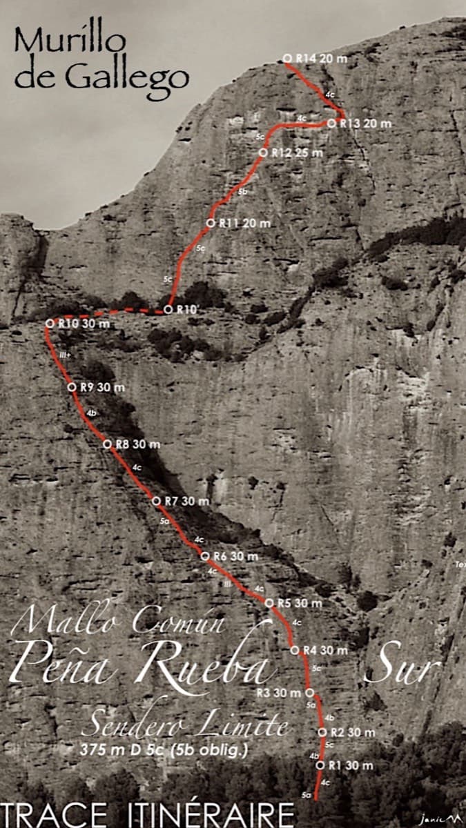
A long beginner's big route on good conglomerate at a moderate angle. Pitches can be linked in pairs with a 60 m rope. A four-pitch headwall with a couple of panzas finishes high above the Gállego valley.

5c14 pitches375 m

Topo of Tierra de Naide, Mallos de Agüero

Spain · Riglos & Agüero (Mallos)

Tierra de Naide

A morning-sun route at the quieter Agüero mallos. Easy slabs separate two fine steep walls, including a superb vertical 5c plaque on pitch 4. Take care with some loose cobbles on the last traverse.

5c5 pitches145 m

Around 4b · about 4 pitches

Similar elsewhere

On Verdauungsweg, Dri Horlini: stepped tawny gneiss above the Almagellerhütte

Switzerland · Saas Valley

Verdauungsweg

The 'digestion route': four 20 m pitches of grade 3 and 4 on solid gneiss, fifteen minutes above the Almagellerhütte at 2900 m. Very closely bolted, with iron rods to stand on at the two steepest steps, and well suited to practising in mountain boots or to a first multipitch after the walk up to the hut.

4b4 pitches80 m

Left side of the Sustenpass south slabs with the starts of Plattenweg, Hörnligödel and Jugendweg marked

Switzerland · Susten

Jugendweg

Seven easy, unsustained pitches of edged slab on the left side of the Steingletscher slabs, never harder than 4b. The line is obvious and the glacier scenery is the main event. A good first multipitch, and easy to pair with a neighbouring route the same day.

4b7 pitches200 m

Looking down the dark gneiss slabs low on Nika, Speroni di Ponte Brolla

Switzerland · Ticino

Nika

The easy neighbour of Quarzader: seven pitches of gneiss slab and small steps up the right-hand spur above the Maggia, at 4b if you take the right-hand finish. Much quieter than Quarzader and very well bolted. Finish with a swim in the river.

4b7 pitches250 m

No photo yet

Germany · Ammergauer Alpen

Wadlziaga

A short, easy alpine route of UIAA 4+ on the Schlössel above the Kenzenhütte: a water runnel, a corner and slabs, then a compact pillar to finish. Bolted where it matters but not closely. Pitch 3 has some unreliable rock and grass.

4c4 pitches140 m

Read the cautions

Compiled from published sources and last verified October 2026. Bolts, anchors and access change. Climbing is dangerous and you are responsible for your own decisions: check a current topo and read the disclaimer.