
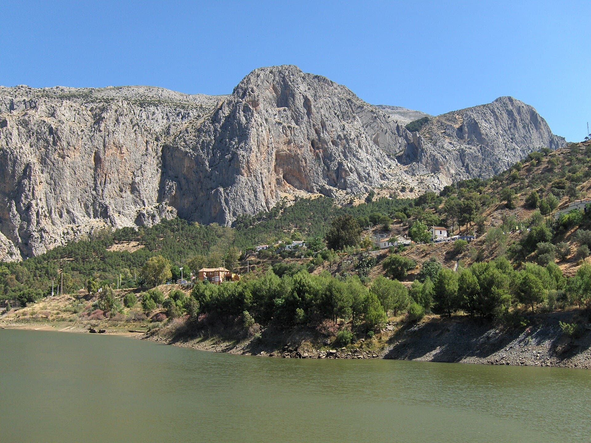
Spain · El Chorro
Amptrax
The absolute El Chorro classic: a physical, sustained line that feels tough for the grade, with a 6a traverse right under the roof. Polished in places from heavy traffic.
6a9 pitches182 m
Westliche Sattelspitze · Karwendel (Innsbruck Nordkette) · Austria
Bail not documentedBolting confidence: high
A plaisir line straight above Innsbruck, reached by cable car. Two pitches are UIAA 6-/6 (5+/A0) and the rest is mostly grade 4–5. The upper pitches are grassy, so avoid it when wet.
The route
A new (2024) bolted line up the south face of the Westliche Sattelspitze (2339 m) on the Nordkette, directly above Innsbruck and reached from the Seegrube cable-car station. About 300 m of varied climbing, mostly UIAA 4 to 5, with two pitches of 6-/6 that can be done at 5+/A0. bergsteigen.com calls the protection 'almost plaisir': good to very good bolts throughout. It is still an alpine outing at over 2000 m with a grassy scramble to the start, poorer rock high up and a via ferrata descent. Only one route description exists so far.
The climbing
| Pitch | Grade | Notes |
|---|---|---|
| P1 | – | – |
| P2 | – | – |
| P3 | – | – |
| P4 | – | Described in a photo caption as a steep pitch. |
| P5 | – | – |
| P6 | – | – |
| P7 | – | – |
| P8 | – | Passes a chockstone (photo caption). |
| P9 | – | – |
Getting there
Innsbruck. Drive or take the bus to the valley station of the Nordkettenbahn (868 m) and ride the cable car to Seegrube (1905 m). bergsteigen.com also mentions riding an e-bike up to Grubegg, about 50 m above the Seegrube top station. Check the cable car's operating times; a neighbouring-route page quotes 8:30 to 17:30 in high summer with late running on Fridays, but verify current times.
About 45 min from Seegrube. Walk west towards the Schmidhubersteig until you are below the Sattelspitzen. Go up scree to a rising grass ramp under the Westliche Sattelspitze, then follow it up left over grass and broken ground (one short step of UIAA 1-) to the start. Descriptions of the neighbouring route Unterwegs on the same face give the same line of approach and 45 min to 1 h.
Loading map
The point marks the base of the route.
Parking
Parking marked on bergsteigen.com
Point from bergsteigen.com touren/klettern/mit-vergnuegen-avec-plaisir-sattelspitze
Contains the route point and parking. Opens in most mapping apps and GPS watches.
Points are compiled from published sources, with the precision stated above. They were not surveyed on the ground: check them against a current topo.
Coordinates: 47.30576, 11.35354 (route base) · Parking: 47.28635, 11.39881
Getting down
From the summit take the Innsbrucker Klettersteig (via ferrata) left, that is west, down to the Frau-Hitt-Sattel. From there follow the Schmidhubersteig, a marked mountain path with some exposed sections, back to Seegrube. bergsteigen.com allows 1 h; another description of the same descent allows 1.5 h. No abseil descent is described for this route.
Retreat
Bail not documented
Retreat is not documented. The only description (bergsteigen.com) gives a via ferrata descent from the summit and says nothing about abseiling, how the belays are rigged or any escape line. Do not count on an equipped abseil line; check the paid topo before you go.
Safety
Sun and weather
South-facing on a 2339 m summit above the Seegrube station (1905 m). The sources give no season; access depends on the Nordkettenbahn running. Avoid it when wet: several grassy passages make it a poor choice.
Sun on the wall · S-facing
Working out the sunlit hours for this month.
Sun on the wallDaylight, wall in shade● Usual season
Estimated from the wall's aspect only. Ignores surrounding terrain, gullies and the wall's exact shape. Clock times are local to the wall (Central European time), for the 15th of each month.
| Measure | Jan | Feb | Mar | Apr | May | Jun (usual season) | Jul (usual season) | Aug (usual season) | Sep (usual season) | Oct (usual season) | Nov | Dec |
|---|---|---|---|---|---|---|---|---|---|---|---|---|
| Mean daily high °C | −7 | −5 | −2 | 2 | 7 | 11 | 13 | 13 | 9 | 5 | −2 | −6 |
| Mean daily low °C | −17 | −15 | −11 | −8 | −3 | 1 | 3 | 3 | −1 | −5 | −11 | −15 |
| Rain days 1 mm or more | 13 | 13 | 15 | 16 | 21 | 21 | 21 | 20 | 16 | 14 | 13 | 13 |
● marks the usual climbing season. Averages for 1991-2020 at about 2267 m. Area climate from Open-Meteo reanalysis. Temperatures are adjusted to the height of the crag; rain comes from a grid cell of about 10 to 25 km, and summer highs on sea cliffs can read a few degrees low. The wall and valley can differ. Data: Open-Meteo, CC BY 4.0.
What to carry
60 m single rope, 15 quickdraws, helmet. No nuts or cams are listed. The descent is on a via ferrata.
Derived from the route data; check it against a current topo
From climbers
Reader reports are not being collected yet. Until they are, check a current topo and the local club or guidebook publisher for recent changes to Mit Vergnügen – avec plaisir.
Worth knowing
Open questions
Provenance
Around 6a · about 9 pitches
Spain · El Chorro
The absolute El Chorro classic: a physical, sustained line that feels tough for the grade, with a 6a traverse right under the roof. Polished in places from heavy traffic.
6a9 pitches182 m
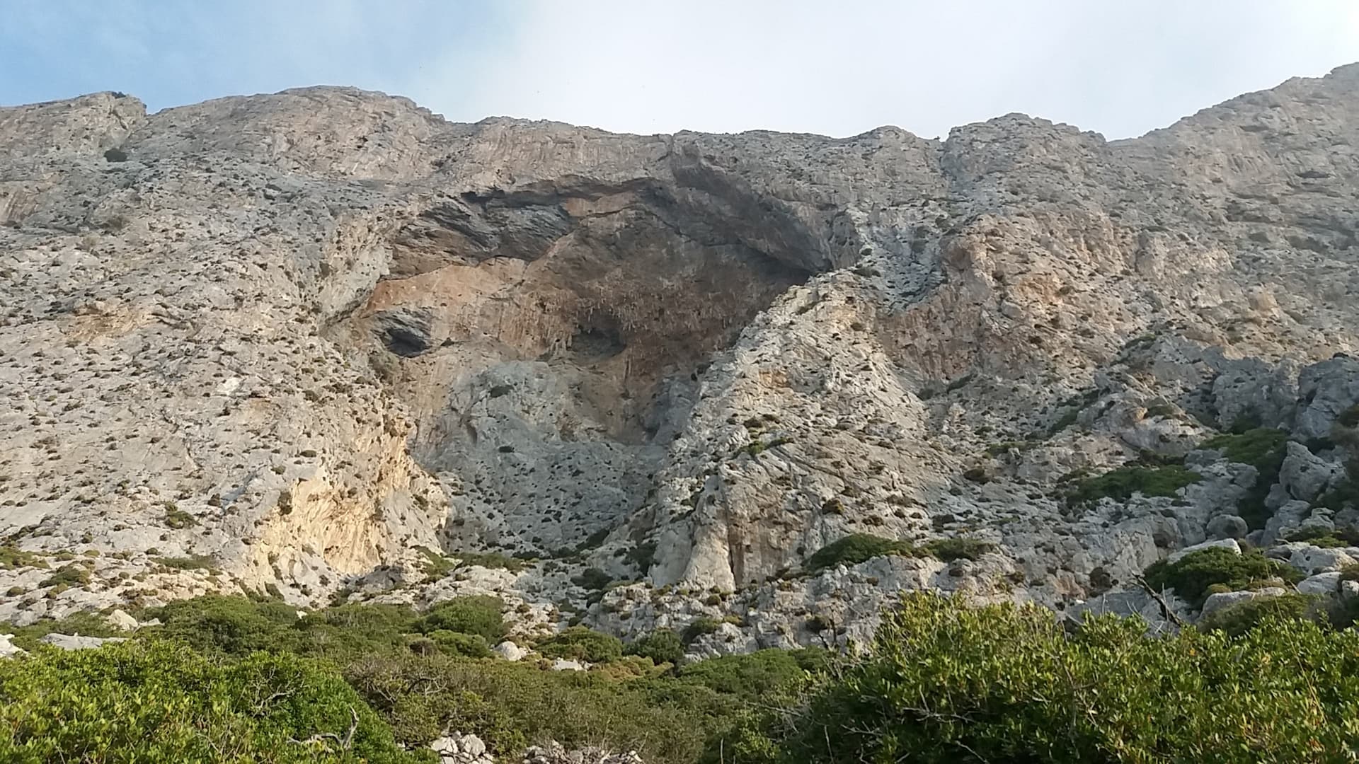
Greece · Kalymnos & Telendos
A sustained, varied line on sculpted limestone. It starts with an easy slab and builds to slightly overhanging jugs with huge exposure on the top pitch. Mountain Project and camptocamp grade the crux 6a+ (Rockfax says 6a). With a 70 m rope you can link several pairs of pitches.
6a9 pitches265 m
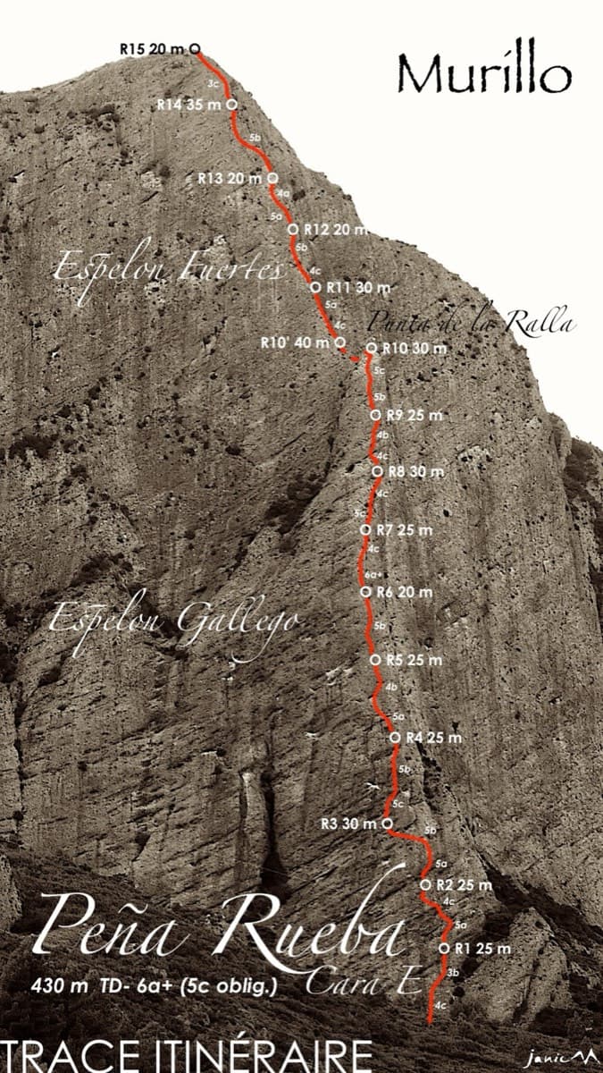
Spain · Riglos & Agüero (Mallos)
An airy spur with sustained 5b–5c climbing, a single 6a step on pitch 7, and big views over the Mallos de Riglos and the Pyrenees.
6a9 pitches230 m
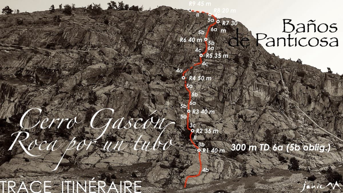
Spain · Aragonese Pyrenees (Tena & Canfranc valleys)
High-mountain granite slabs and dihedrals above the Panticosa spa. Three 6a cruxes mix friction slab with a short flaky roof on pitch 7.
6a9 pitches300 m
Read the cautions
Compiled from published sources and last verified October 2026. Bolts, anchors and access change. Climbing is dangerous and you are responsible for your own decisions: check a current topo and read the disclaimer.