Multipitch Atlas

La mémoire de l'eau

Tête d'Aval de Montbrison · Briançonnais · France

Read the cautionsBail with caveatsBolting confidence: medium

One of the most admired lines on the Tête d'Aval: eleven sustained pitches, first up steep cracks and walls, then across orange limestone studded with small spikes. The grade is 6c with a 6c+ passage that has a fixed sling for aid, and 6b is obligatory. Parties advise being comfortable at 6c, because the bolting is sound but not generous.

Sketch topo of the Ranxerox sector of the Tête d'Aval; La mémoire de l'eau is the line marked MEPhoto: CH · CC BY-SA 3.0

Topo

Sketch topo of the Ranxerox sector of the Tête d'Aval; La mémoire de l'eau is the line marked MEPhoto: CH · CC BY-SA 3.0
Hardest pitch
6c+
Pitches
11
Length
300 m
Approach
80 min
Aspect
SE
South-east-facing
Rope
2×50 m
Read before you go

Fully bolted but engaged for a sport route, with spaced bolts in places, some old bolts and poor rock on easy ground; come with a margin at 6c.

The route

Overview

La mémoire de l'eau climbs the Tête d'Aval just right of Ranxerox in two halves separated by a big ledge. The lower five pitches are steep and physical, with a bouldery 6c first pitch, a superb vertical crack on pitch 3 and a roof on pitch 5. Above the ledge the rock changes to rough orange and grey limestone covered in small spikes, with a technical leftward traverse on pitch 8 and the 6c+ crux wall on pitch 9. The route crosses and shares ground with several others, so the topo needs careful reading. It is sustained, and parties report 4 to 8 hours on the wall.

The climbing

Pitch by pitch

Pitches of La mémoire de l'eau
PitchGradeLengthNotes
P16c40 mA long, rough pitch with at least three hard sections: the start, a tiny corner at half height and the finish. Gulliver gives 6b/c and suggests pulling on the first bolt at the violent opening boulder problem. Two 2025 parties warn of exposed starts on this route with a risk of landing on the belayer or the ground.
P26c25 mA rising traverse right on red rock (5c), then a bouldery section on a steep wall with side-pulls. Rock on the easy part is less good.
P36b+35 mA superb, almost Chamonix-style crack; physical at the start, with bolts that are not close. Gulliver has the hardest part at the end, traversing right under a roof and up a slab.
P46b25 mA steep wall with a bouldery move at the start, then sustained but easier. Belay on the right beside the tree; 'ME' and 'PDT' are painted at the start.
P56a+30 mAn awkward exit from a roof, then a very pleasant, easier pitch to the big ledge. A 2025 party noted a few old 8 mm bolts. From the ledge go down a little to the left to a belay below a characteristic grey slab.
P65c25 mA very pleasant slab pitch traversing left.
P76b25 mFeatured rock, then an exit on small spikes.
P86b+25 mA superb traverse on red spikes, then a more athletic exit on grey rock. Early in the season a waterfall from the melting summit snowfields can cut this pitch; you can abseil from the belay below.
P96c+25 mA steep slabby wall with a fixed sling to stand in if needed, a short traverse right and an exit on runnels. Camptocamp grades it 6c/6c+, Gulliver 6c+ or A0. In May 2025 this pitch was running with water in the afternoon.
P106b+35 mA slab on spikes, then an overhanging traverse right; extend the last quickdraw before the traverse by more than 60 cm. Camptocamp gives 6b+/6c and describes a new two-bolt belay on a platform. Gulliver found far-apart bolts, some poor rock and a belay on a single bolt to be backed up, and advises cams here.
P115a15 mA very short pitch up a crack on the left to the final ledge; Gulliver noted one bolt.

Getting there

Approach

To the parking

From Briançon via Prelles, or from Gap via L'Argentière-la-Bessée, go to Les Vigneaux. Take the forest track that starts 150 m west of the church and follow it for several kilometres to a parking place beside a big boulder at about 1500 m (the Barthalay ruins). The track is steep and stony; a 2026 party on electric bikes ended up pushing.

On foot · about 80 min

1 h 15 min to 1 h 35 min. From the parking place continue on the forest track that leaves left before the boulder and climbs straight up. At its end (200 m) cross a stream on the left and take the lower path to the Marcellin spring (water), about 30 min. From the spring climb the partly cleared spur (right at the cairn) until you meet the wall, traverse right and keep climbing to a vague levelling. To reach the Ranxerox sector, descend right round a pillar and climb again past a spring. 'ME' is painted at the start, a little right of Ranxerox ('RX').

Finding the route · 1 photo

Approach photo

Map of the walk-in

  • Crag
  • Parking
  • GPS line

Loading map

The point marks the crag, not the exact start of the route.

GPS line: one party's recorded GPS track of the whole day, including the climb and the descent. One party's recorded day on 26 May 2024 from the Barthalay ruins parking: walk-in, the climb as far as pitch 7 (they retreated there) and the return. Thinned from 353 to 300 points. Do not follow it blindly.

GPS line: o.laurendeau · CC BY-NC-ND 3.0

Coordinates · crag

44.84819, 6.53291

Parking

44.83400, 6.53950

Les Vigneaux, Ruines Barthalay (camptocamp waypoint 181243)

Point from camptocamp waypoint 42358

For your phone or watch

Download GPX

Contains the route point, parking and a GPS line. Opens in most mapping apps and GPS watches.

Points are compiled from published sources, with the precision stated above. They were not surveyed on the ground: check them against a current topo.

Getting down

Descent

From the top, traverse about 20 m left along the ledge; two equipped belays let you protect the way to the first chained abseil station at the edge of the ledge, at the top of the Grand Toit. Four abseils of 50 m, the first free-hanging, lead to a ledge with worn fixed ropes, which you follow on foot and by down-climbing (easy but exposed) back towards the base. A 2025 party looked for a further abseil station from that ledge and found none. Allow about 1 h to the foot of the route and just under 1 h more to the car.

Retreat

Bailing off the route

Bail with caveats

The normal descent is by a separate abseil line, not down the route, and retreat from the route itself is only partly documented. Camptocamp states that you can abseil from the belay below pitch 8 if water blocks the way. From the big ledge after pitch 5 other routes and the abseil line of the sector are nearby, but no source describes using them. With two 50 m ropes and bolted belays, abseiling the lower pitches is plausible; the traverses on pitches 2, 6 and 8 complicate it.

Retreat from
The belay at the top of pitch 7 (stated). The lower five pitches and the ledge above them (inferred).
Point of no return
Not documented. Above pitch 8, which traverses a long way left, going down becomes awkward and the top is three pitches away.
Carry
2×50 m ropes, maillons and cord to leave.
Basis
Part stated, part inferredAbseil from below pitch 8 is stated on camptocamp; everything else is inferred from the bolted belays, pitch lengths and traverses.

Partly inferred from the route facts

Safety

Hazards

  • Bolting is sound but not generous: run-out on easy ground and spaced on some climbing sections such as pitch 3. A September 2025 party describes several exposed pitch starts and a few poorly placed bolts (second bolt of pitch 3, second of pitch 6, last of pitch 9).
  • Some poor rock on easier sections, including the easy part of pitch 2 and parts of pitch 10.
  • Meltwater on pitches 8 and 9 early in the season.
  • The fixed ropes on the descent ledge are worn; stay roped.
  • Several routes cross here (Ranxerox, Pilier Rouge Hebdo, Polichinelle); it is easy to follow the wrong bolts, notably on pitch 4 and on the ledge after pitch 5.

Sun and weather

Conditions

South-east facing (south-west according to Gulliver) from about 2000 m. In May and early summer meltwater affects pitches 8 and 9, worse in the afternoon; one May party says you need to be at pitch 8 by about 15:00. Reports run from mid May to the end of September, and summer parties start early to climb in the cool.

Usual season · May to Oct

Sun on the wall · SE-facing

Working out the sunlit hours for this month.

  • January: not yet worked out
  • February: not yet worked out
  • March: not yet worked out
  • April: not yet worked out
  • May (usual season): not yet worked out
  • June (usual season): not yet worked out
  • July (usual season): not yet worked out
  • August (usual season): not yet worked out
  • September (usual season): not yet worked out
  • October (usual season): not yet worked out
  • November: not yet worked out
  • December: not yet worked out

Sun on the wallDaylight, wall in shade● Usual season

Estimated from the wall's aspect only. Ignores surrounding terrain, gullies and the wall's exact shape. Clock times are local to the wall (Central European time), for the 15th of each month.

Climate figures for Briançonnais are not available yet

What to carry

Gear

Two 50 m ropes. 13 to 14 quickdraws with several extendable; 16 or 17 if you link pitches 3 and 4 or 10 and 11 on a 60 m rope. Gulliver recommends small to medium cams, mainly for pitch 10, while a 2023 party used no trad gear at all. Helmet.

Checklist

Quickdraws
14
Rope
2×50 m
Helmet
One each
Abseil device and prusik
The descent or the retreat involves abseiling
Maillons or spare karabiners
To leave behind if you retreat
Cord
Mentioned for retreat

Derived from the route data; check it against a current topo

From climbers

Reader reports

Reader reports are not being collected yet. Until they are, check a current topo and the local club or guidebook publisher for recent changes to La mémoire de l'eau.

Worth knowing

Tips

  • A popular combination suggested in Arnaud Petit's book: Ranxerox pitches 1 to 5, La mémoire de l'eau pitches 6 to 11, then Ranxerox to the top.
  • The crux on pitch 9 can be aided with the fixed sling; 6b remains obligatory elsewhere.
  • Fill up at the Marcellin spring on the approach.
  • Reported days run from 9 to 13 hours car to car.

Open questions

Where sources disagree

  • Equipment quality: 'excellent' or 'top' according to parties in 2024, May 2025 and 2026; 'mixed, exposed in places, even dangerous' according to one September 2025 party; 'solid but without frills' according to another the same month.
  • Pitch 10 belay: camptocamp describes a new two-bolt belay on a platform after the 2021 work; Gulliver (page last revised January 2023, ascent date not given) describes a single bolt to be reinforced. The camptocamp version is the more recent work.
  • Cams: recommended by Gulliver, not used by a 2023 party, not mentioned on camptocamp.
  • Grades: pitch 1 is 6c on camptocamp and 6b/c on Gulliver; pitch 3 is 6b+ against 6b; pitch 4 is 6b against 6a+. A 2025 party graded pitches 2, 4 and 5 lower still.
  • Aspect: SE on camptocamp, SW on Gulliver.
  • Pitch lengths are Gulliver's; camptocamp gives none.

Provenance

Sources

Around 6c+ · about 11 pitches

Similar elsewhere

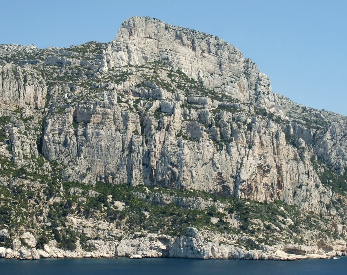
The Grande Candelle and its plinth from the sea; Armata Calanca climbs the plinth and then the south face to the summit

France · Calanques

Armata Calanca

The big modern classic of the Calanques: eleven pitches in three tiers from the foot of the Candelle plinth to the summit, sustained in the sixth grade on grey water-pocketed limestone above the sea. Two walking ledges split the day and offer escapes. The eighth pitch, a 6b+ diagonal along a flake, is the one people remember.

6c11 pitches320 m
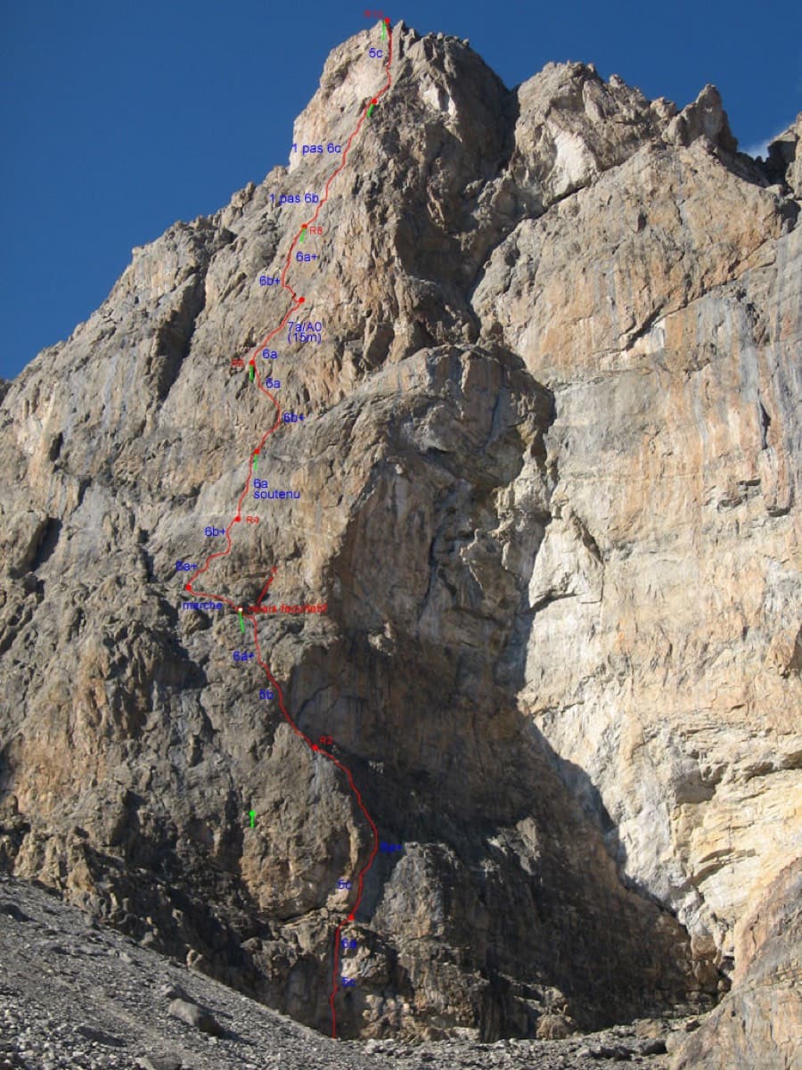
Photo-topo of Feu Sacré on the south-west face of the Tour Termier

France · Cerces

Feu Sacré

The classic hard route of the Tour Termier: ten steep, technical pitches on superb compact limestone at 3000 m, a short walk from the Col du Galibier road. It is never athletic but sustained at 6a+ to 6b, with a 7a pitch and a 6c move that both go at 6a A0. Cold, wind and thin footwork make it feel bigger than the numbers.

7a10 pitches320 m

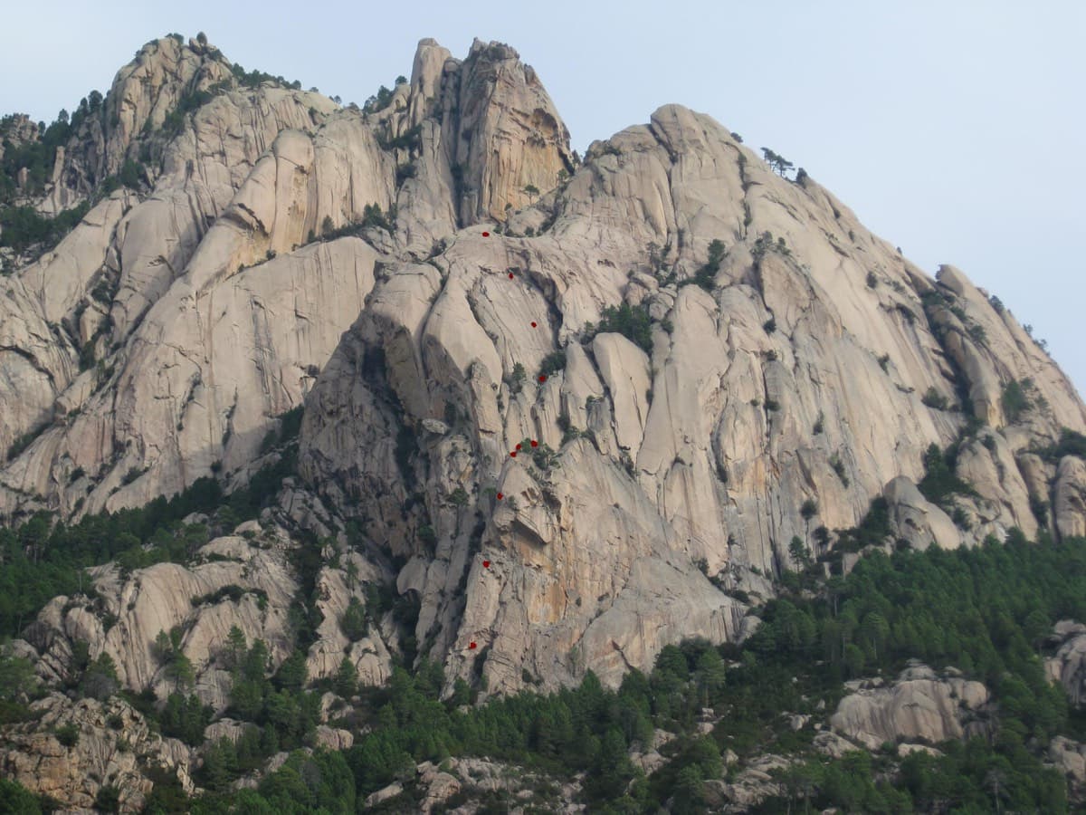
Teghie Lisce, Bavella, with the belays of Acqua in bocca marked in red

France · Bavella

Acqua in bocca

A sampler of everything Bavella granite does: a technical 7a wall, layback and jamming cracks, an off-width, a squeeze slot behind a tree, and three pitches of pure friction slab to finish. Bolted well enough to climb on quickdraws, which is rare here. The wide pitches are awkward and bruising if you are not used to the style.

7a10 pitches300 m

Read the cautions

No photo yet

Italy · Arco & Valle del Sarca

Nataraj

Steep, athletic corner climbing on the Mandrea wall above Arco, with pocketed slabs where the corner turns loose. Mostly 6a to 6b with a harder move on pitch 5 and the crux in the last pitch; both go at A0. The long layback corner near the top is the pitch people remember.

6c10 pitches275 m

Compiled from published sources and last verified October 2026. Bolts, anchors and access change. Climbing is dangerous and you are responsible for your own decisions: check a current topo and read the disclaimer.